Hardcastle Crags Walk from Hebden Bridge
![]()
![]() Explore this beautiful wooded valley in the South Pennines on this walk around Hardcastle Crags. There are 15 miles of walking paths taking you to tumbling streams, beautiful waterfalls and the fantastic Gibson Mill. Here you will find an excellent visitor centre with interactive displays telling the history of the valley over the past 200 years.
Explore this beautiful wooded valley in the South Pennines on this walk around Hardcastle Crags. There are 15 miles of walking paths taking you to tumbling streams, beautiful waterfalls and the fantastic Gibson Mill. Here you will find an excellent visitor centre with interactive displays telling the history of the valley over the past 200 years.
The circular walk below starts in the nearby town of Hebden Bridge and takes you along Hebden Water on the Haworth-Hebden Bridge Walking Path. It's a nice riverside walk to the site which runs for about 1.5 miles.
If you would like to continue your walk why not head up to the nearby Widdop Reservoir where you will find more waterside walking and stunning scenery.
You could also try the Hebden Bridge Circular Walk which will take you on a tour of the rivers, canals and moorland hills surrounding the town.
Postcode
HX7 7AW - Please note: Postcode may be approximate for some rural locationsPlease click here for more information
Hardcastle Crags Ordnance Survey Map  - view and print off detailed OS map
Hardcastle Crags Open Street Map  - view and print off detailed map
*New* - Walks and Cycle Routes Near Me Map - Waymarked Routes and Mountain Bike Trails>>
Hardcastle Crags OS Map  - Mobile GPS OS Map with Location tracking
Hardcastle Crags Open Street Map  - Mobile GPS Map with Location tracking
Pubs/Cafes
There's a nice on site cafe inside the picturesque Gibson Mill. Run by the National Trust it includes outdoor seating with nice views of the river. The historic mill was built in the 1800s as part of the industrial revolution. It was driven by a water wheel and produced cotton cloth up until 1890. The mill is totally self-sufficient with electricity created from the natural surroundings.
The Pack Horse Inn is another worthy option, positioned just above the crags. This interesting historic pub is located in a very remote position and dates from the 17th century. Inside there's a cosy bar with fires, window seats cut into the partly panelled stripped-stone walls (from where you can take in the beautiful views), sturdy furnishings and some horse related mementoes. There are also seats outside in the cobblestoned beer garden which has attractive hanging baskets. They have a good selection of ales, a decent menu and are also dog friendly. You can find the pub on the Widdop Road just north west of the crags, at a postcode of HX7 7AT.
In Hebden Bridge there's the excellent Rim Nam Thai Restaurant. It's located in a wonderful spot right on the canal side just a short distance from The Hebden Bridge Picture House. It's a great place to enjoy a fine meal with a lovely scenic view. You can find it at Butlers Wharf at postcode HX7 8AF. A little to the west of the town centre there's also the noteworthy Fox & Goose Inn. The pub is the first community-owned pub in West Yorkshire. The friendly place is well worth some investigation with its cosy interior with a roaring fire and an exhibition space for local artists to display their work. Outside there's a lovely hillside beer garden which is great on warmer days. You can find the pub at 7 Heptonstall Road with a postcode of HX7 6AZ for your sat navs.
Dog Walking
The crags are a splendid place for a dog walk and they can be off the lead in most areas. The woodland and the streams are perfect places for your four legged friend to explore. During the warmer months you will likely see plenty of other dogs running around the area. The Fox and Goose Pub in Hebden Bridge is very dog friendly. Water and free biscuits are available at the bar for your pet here.
Further Information and Other Local Ideas
Hebden Bridge railway station is about 2 miles from the site. If you would like to try this walk by public transport you can catch the train directly to the town from several nearby towns and cities. The station is on the Calder Valley Line, operated by Northern, from York and Leeds towards Manchester Victoria, Blackpool and Preston. From the station you can then follow the waymarked Haworth-Hebden Bridge Walk north to the site.
After visiting the crags you could head into Hebden Bridge to pick up the Rochdale Canal. The walk along the towpath into Sowerby Bridge is a popular one to try. It makes for a nice extension to your outing with lots of barges and fine Yorkshire countryside to see.
Just to the east of the crags is one of the hidden gems of the area at Lumb Hole Falls. These pretty waterfalls are located on the Crimsworth Beck and are a popular place for wild swimming and walks. There's also a plaque to Ted Hughes poem 'Six young Men' which concerns a group of men photographed at the falls shortly before they went to fight in the first World War.
Just to the south of the site you can pick up the Hebdon Bridge to Heptonstall Walk and visit the classic old Yorkshire village. There's some interesting old buildings in the village including the 16th century Stag Cottage and the ruined church which was founded in 1260. There's also some fine old pubs to investigate here as well.
For more walking ideas in the county see the Yorkshire Walks page.
Cycle Routes and Walking Routes Nearby
Photos
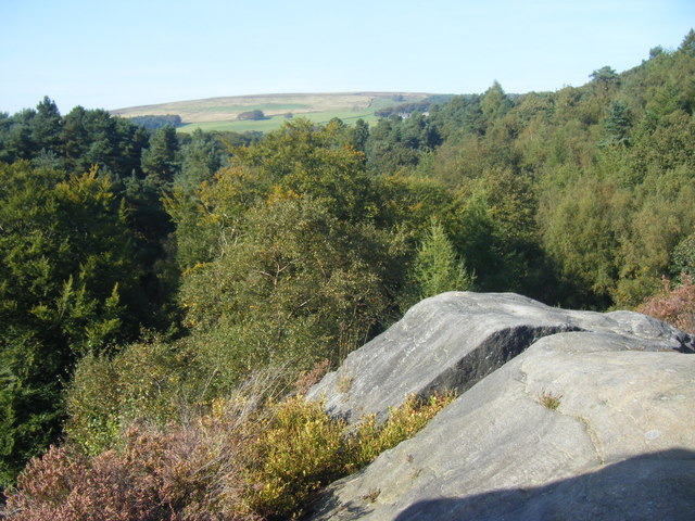
Above the Woodland at Hardcastle Crags. Taken from the top of the crag marked at 236m on the OS 1:25000 map. The woodland shrouded second crag can be seen to the left, with distant views towards Wadsworth Moor.
The woodlands are predominantly composed of oak, beech, and pine trees, providing a habitat for a diverse range of plant species. The ground flora is typical of acid woodland, featuring species such as bluebells, wood sorrel, and ferns. Additionally, the fields around Hardcastle Crags are home to over 400 species of fungi, some of which are incredibly rare and thrive in the area's specific conditions.
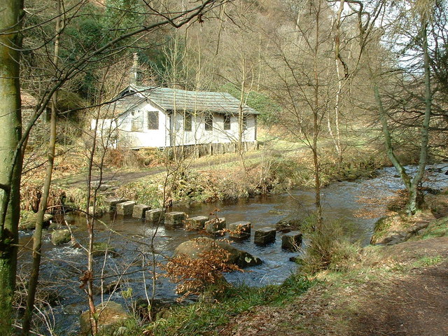
Hebden Water and the Millpond. The varied habitats support a wide array of wildlife. Bird enthusiasts can spot species such as blackbirds, blue tits, common redstarts, cuckoos, bullfinches, buzzards, chaffinches, coal tits, woodcocks, and many others. The presence of these birds adds to the vibrant natural soundscape of the valley.
The name 'Hardcastle Crags' is used to refer to the whole of the National Trusts estate on both sides of Hebden Dale . Most visitors don't stray past Gibson Mill. The Crags themselves are to the north of that point between the main track and the Hebden Water
Gibson Mill Visitor Centre. Looking north within the courtyard of Gibson Mill. The mill was constructed in 1805 and stood as one of the pioneering cotton mills during the Industrial Revolution. Before this era, weaving primarily occurred within individuals' homes, and the concept of a 'factory' was relatively novel. Erected by the Gibson family, proprietors of the nearby Greenwood Lee, a residence situated above Slack village, they were prominent local landowners and farmers who readily embraced emerging technologies. Initially, Gibson Mill was leased by Titus and James Gaukroger. Historical records indicate that both men and women, including children as young as ten, were employed at the mill. The weaving shed was later appended in 1840, followed by the addition of an engine shed in 1867. Gibson Mill remained engaged in cotton cloth production until 1890.
Gateway and Lodge at the crags. This is the entrance to the National Trust land. The members' car park is on the left. Most of the land (87 ha) was given by the third Baron Savile in 1950.
In addition to housing Gibson Mill, the vicinity surrounding Hardcastle Crags emerged as a significant industrial site, marked by the construction of three new reservoirs to cater to the expanding town of Halifax.
Situated on the moorland above Hardcastle Crags, these reservoirs were established in an especially isolated region. To transport materials and accommodate workers, a railway and a provisional settlement were erected in 1900, with workers residing there until 1908.
Storage building and timber stacks near Gibson Mill. The 66 hectares of mixed woodland at Hardcastle Crags is managed sustainably to provide fuel for heating at Gibson Mill. This building seems to be part of that operation.
By 1902, operations at Gibson Mill had come to a halt. The upper floor of the mill underwent conversion into a café, while numerous refreshment rooms were erected across the woodland.
Several ex-mill workers secured employment within this burgeoning tourist centre. Starting from approximately 1894, the Pavillion eatery was managed by Lister Hollindrake, formerly a resident of the mill's attached cottages and a cotton warp dresser by trade.
William Shackleton, who oversaw the restaurant on the upper floor, had also previously toiled in the mill, albeit in the capacity of an engine tender. In addition to enjoying cafés and dancing at Gibson Mill, visitors could also partake in swings and take boats out on the mill pond. By the 1920s, the annual visitor count at Hardcastle Crags exceeded 500,000.
In 1929, a turbine was installed at Gibson Mill to produce electricity. Following the Second World War, a roller skating rink was set up in the weaving shed. Arnold Binns, a world champion skater, provided skating lessons there.


