Lee Valley
9 miles (14 km)

 This short, pleasant traffic free ride takes you through Lee Valley Park and along the River Lee.
This is an easy ride through a scenic country park with designated cycle paths.
The nearest town to the route start point is Broxbourne just to the north.
Lee Valley Ordnance Survey Map  - view and print off detailed OS map
Lee Valley Open Street Map  - view and print off detailed map
Lee Valley OS Map  - Mobile GPS OS Map with Location tracking
Lee Valley Open Street Map  - Mobile GPS Map with Location tracking
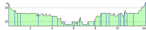
Elevation Profile