Morecambe Bay Circular Cycle and Walk Map
![]()
![]() Enjoy a visit to the Morecambe Bay Nature Reserve and a stroll along the Lancaster Canal on this circular cycle or walk in Lancashire.
Enjoy a visit to the Morecambe Bay Nature Reserve and a stroll along the Lancaster Canal on this circular cycle or walk in Lancashire.
The walk starts in the town centre of Morecambe near to the train station. You then pick up the Lancashire Coastal Way to take you along the promenade towards Hest Bank and Bolton-le-Sands. You'll pass the Eric Morecambe statue with great views over the bay towards the Lake District. There's also a great deal of coastal wildlife to look out for including Cormorants, Curlews, Lapwings and Oystercatchers. The area is a RSPB reserve with sandflats and saltmarshes that attract thousands of birds. As such it is considered the second most important estuary in the UK.
From Hest Bank you turn inland and follow the Lancaster Canal into Lancaster before another waterside sectoin along the River Lune. A shared footpath and cycleway then returns you to Morecambe though White Lund.
To continue your walking in the area you can head along the Lancashire Coastal Way to Bolton le Sands and Carnforth.
You can also head south of Heysham and visit the delightful Sunderland Point. It's a lovely place for a walk with coastal views, salt marsh, beach, mud flats, farmland and lots of wildlife to look out for. There's also a series of attractive Georgian houses by the quay.
Postcode
LA4 4BU - Please note: Postcode may be approximate for some rural locationsMorecambe Bay Ordnance Survey Map  - view and print off detailed OS map
Morecambe Bay Open Street Map  - view and print off detailed map
*New* - Walks and Cycle Routes Near Me Map - Waymarked Routes and Mountain Bike Trails>>
Morecambe Bay OS Map  - Mobile GPS OS Map with Location tracking
Morecambe Bay Open Street Map  - Mobile GPS Map with Location tracking
Explore the Area with Google Street View 
Cycle Routes and Walking Routes Nearby
Photos
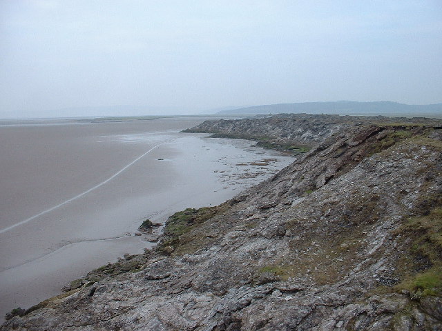
Limestone outcrop, Morecambe Bay. This is a very strange line of rocks, about a mile off shore, which I guess was originally exposed by the River Keer, though the channel now goes in a very different direction. The area has been used as landfill, though this has stopped, but the outcrop has a lot of different material dumped on top. There are many circular inclusions [about 3 to 4 ft across] in the limestone - one is just visible in the lower centre of the photo
Morecambe seashore & groynes. Looking south, with Heysham in the background [the nuclear power station just visible on the right of the hilltop]
Morecambe Bay crossing. The line of walkers with the Land Rover have just completed a crossing of the quicksands of the bay . Arnside from where they started is way over to the left


