GPS Cycle and Walking Routes

National Cycle Route 56

41 miles (66 km)

This signed Sustrans Cycle Route takes you from the city of Chester to Liverpool, passing through the lovely Wirral Peninsula on the way.
The route runs for just over 40 miles and includes a ferry crossing over the River Mersey.
Highlights on the route include the historic Royal Albert Dock in Liverpool where there are a number of museums, art galleries and cafes.
Part of the route uses a section of the Wirral Way.
At the Liverpool end of the ride the route links up with a traffic free section of the Trans Pennine Trail and the Liverpool Loop Line at Childwall.

National Cycle Route 56 OS Map - Mobile GPS OS Map with Location tracking

National Cycle Route 56 Open Street Map - Mobile GPS Map with Location tracking

Cycle Routes and Walking Routes Nearby

Photos

Wirral Way, Willaston 3

Wirral Way, Willaston

Northgate Arena - geograph.org.uk - 2907622

Northgate Arena, Chester

Benkid77 The Wirral Way, Parkgate 4 240709

The Wirral Way has an at grade crossing with the B5135 road (Station Road) at Parkgate, Cheshire, England. National cycle route 56 also runs through here.

All's quiet on the NCR 56 - geograph.org.uk - 2049963

Wirral  path

A riverside walk - geograph.org.uk - 3251352

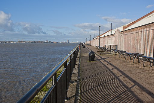
A riverside walk Liverpool

NCR 56 waymarker at Wallasey (geograph 2049999)

NCR 56 waymarker at Wallasey

Albert Dock - geograph.org.uk - 1821225

Albert Dock, Liverpool

Sefton Park - The lake - geograph.org.uk - 1883107

Sefton Park, Liverpool

GPS Files

GPX File

National Cycle Route 56.gpx (On Desktop:Right Click>'Save As. On Ipad/Iphone:Click and hold>Share>Save to Files')