National Forest Trail
24.9 miles (40 km)
![]()
![]() Explore the National Forest in Leicestershire and Derbyshire on this super figure-of-eight cycle ride. The ride follows country lanes through woodland and countryside near Burton Upon Trent, visiting Donisthorpe Country Park, Conkers Waterside and Moira.
Explore the National Forest in Leicestershire and Derbyshire on this super figure-of-eight cycle ride. The ride follows country lanes through woodland and countryside near Burton Upon Trent, visiting Donisthorpe Country Park, Conkers Waterside and Moira.
In Moira there's the splendid Moira Furnace on the Ashby Canal to visit. There's a fine country park here with woodland and parkland trails surrounding the early 19th century iron furnace. There's also a museum featuring lime kilns and craft workshops. Here you can learn all about Moira's significant part in the industrial revolution. The woods, ponds and mountain bike trails of Hicks Lodge are also located just east of the site.
Please click here for more information
National Forest Trail Ordnance Survey Map  - view and print off detailed OS map
National Forest Trail Open Street Map  - view and print off detailed map
National Forest Trail OS Map  - Mobile GPS OS Map with Location tracking
National Forest Trail Open Street Map  - Mobile GPS Map with Location tracking
Cycle Routes and Walking Routes Nearby
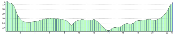
Elevation Profile