Aberporth Coastal Path Walk
![]()
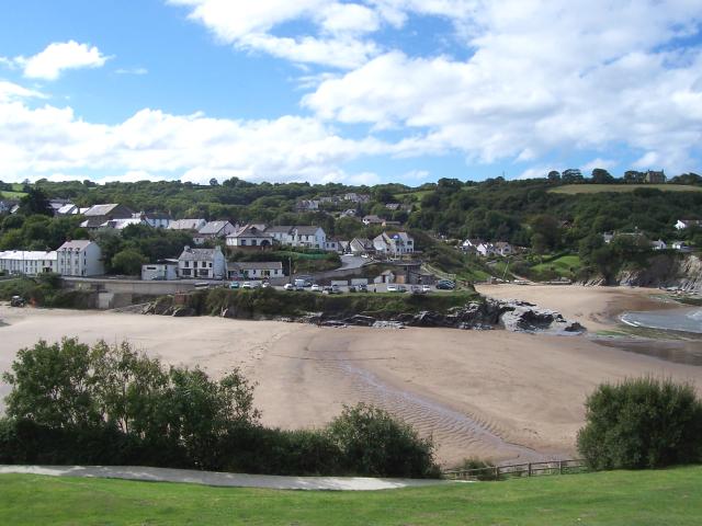
![]() This walk follows a section of the Ceredigion Coast Path from the village of Aberporth to Tresaith and Traeth Penbryn. It's a beautiful area with sandy beaches, waterfalls and marvellous sea views on the way. The route runs for about 2.5 miles so 5 miles there and back. On the way there's some moderate climbs up to the cliffs near Penbryn.
This walk follows a section of the Ceredigion Coast Path from the village of Aberporth to Tresaith and Traeth Penbryn. It's a beautiful area with sandy beaches, waterfalls and marvellous sea views on the way. The route runs for about 2.5 miles so 5 miles there and back. On the way there's some moderate climbs up to the cliffs near Penbryn.
The walk starts at Aberporth Bay where there's a blue flag beach. Here you can pick up the coast path and follow it east to Tresaith. There's another nice beach here with a waterfall over the cliffs from the Afon Saith. The area is great for wildlife too with a variety of seabirds, grey seals and dolphins to look out for.
The final section runs from Tresaith to Penbryn passing the caravan park on the way. Here you'll find a 1.5 mile (2.4 km) long sandy beach owned by the National Trust. The cliff tops here are also quite steep, providing fine views over Cardigan Bay.
To extend the walk you can continue east to Llangrannog where you can climb to the Pendinas Lochtyn hillfort. See the Aberporth to Llangrannog Coastal Path Walk for more details. If you head west along the coast path you can visit the lovely town of Cardigan and the 13th century Cilgerran castle on the River Teifi Estuary.
Aberporth Ordnance Survey Map  - view and print off detailed OS map
Aberporth Open Street Map  - view and print off detailed map
Aberporth OS Map  - Mobile GPS OS Map with Location tracking
Aberporth Open Street Map  - Mobile GPS Map with Location tracking
Pubs/Cafes
In Aberporth you'll find the Ship Inn for some refreshments after your walk. The inn includes a traditional bar and dining rooms with views overlooking the sea. It's a great spot to enjoy some delicous sea food. You can find the inn at a postcode of SA43 2DB for your sat navs.
Dog Walking
The coastal path is a great for a bracing walk with fit dogs. The Ship Inn mentioned above is also dog friendly.
Further Information and Other Local Ideas
The Cardigan Walk takes you along the Teifi Estuary to the 12th century ruined abbey at St Dogmaels, the sandy beach at Poppit Sands and the wonderful viewpoint at Cemaes Head. It's a lovely area with fine views to Cardigan Island and beyond.
Head north along the coast path and it will take you to the neighbouring village of Llangrannog. Here you'll find an excellent blue flag beach and a wonderful headland area with fine views over the bay. There's also an elevated hill fort and views of the River Hawen's waterfall in the village centre. In the village you can pick up the Llangrannog to Cwmtydu Walk and continue north to the beautiful secluded cove at Cwmtydu. The beach is a great place to look out for seals during September and October.
To the west there's the Aberporth to Mwnt Coastal Path. National Trust owned Mwnt is a lovely place to visit with a secluded bay, lovely beach and fine views from Foel y Mwnt.
If you head south there's the wonderful Cenarth Falls where you can see the leaping salmon in the autumn months. The historic town of Newcastle Emlyn with and its ruined Norman castle, can also be visited in this area.


