An Sgurr Eigg Walk
![]()
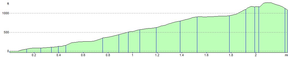
![]() Climb to the highest point on the volcanic island of Eigg on this challenging walk in the Scottish Inner Hebrides. From the 393 metres (1,289 ft) summit there are spectacular views all round of Mull, Coll, Muck, the Outer Hebrides, Rum, Skye, and the mountains of Lochaber on the mainland.
Climb to the highest point on the volcanic island of Eigg on this challenging walk in the Scottish Inner Hebrides. From the 393 metres (1,289 ft) summit there are spectacular views all round of Mull, Coll, Muck, the Outer Hebrides, Rum, Skye, and the mountains of Lochaber on the mainland.
The walk starts at the ferry terminal and follows a waymarked route through Galmisdale and heather and bracken moorland to the summit.
You can continue your walking around the island by picking up the Singing Sands Trail at the ferry terminal. This waymarked trail will take you to the northern part of the island where you there's a circular loop walk around Cleadale to enjoy.
An Sgurr Eigg Ordnance Survey Map  - view and print off detailed OS map
An Sgurr Eigg Open Street Map  - view and print off detailed map
An Sgurr Eigg OS Map  - Mobile GPS OS Map with Location tracking
An Sgurr Eigg Open Street Map  - Mobile GPS Map with Location tracking
Photos

An Sgurr, Eigg

Eigg

Rum from An Sgurr, Eigg

Vanessa style triangulation pillar on An Sgurr, Eigg

An Sgůrr and Galmisdale House

Small Lochan on An Sgurr
Elevation Profile