GPS Cycle and Walking Routes

Anstruther to Crail Walk

4 miles (6.5 km)

This walk follows a popular section of the Fife Coastal Path from Anstruther to Crail.
It's roughly a four mile walk, passing along a fairly flat section of the path. Along the way there's fine coastal views and a series of photogenic rock formations, weathered caves and cliffs to see.
The walk starts from the attractive harbour in Anstruther, following the waymarked trail north east past Cellardyke Habrour, Cardinal Steps and the activities centre. You continue past Caiplie to Hermit's Well and The Coves before passing Maggie Brady's Rock and finishing at the harbour in Crail.
To continue your walking along the coast path you could head to St Andrews or Pittenweem.

Anstruther to Crail OS Map - Mobile GPS OS Map with Location tracking

Anstruther to Crail Open Street Map - Mobile GPS Map with Location tracking

Photos

Anstruther Harbour - geograph.org.uk - 2566834

Anstruther Harbour

Harbour, Cellardyke - geograph.org.uk - 159386

Harbour, Cellardyke

Gate on the Fife Coastal Path - geograph.org.uk - 3073465

Gate on the Fife Coastal Path

Caiplie - geograph.org.uk - 3643147

Caiplie

Caiplie Caves - geograph.org.uk - 1195469

Caiplie Caves. Weathered and eroded over the millennia by the action of wind and tide, this chunk of red sandstone now stands isolated. Medieval chronicles associate Caplie with St. Adrian (or St. Ethernan) who was killed on the Isle of May in 875 by Viking raiders. Christian crosses carved into the wall of Chapel Cave give credence to the theory that this was a shrine to the martyred saint.

Coastal path - geograph.org.uk - 870523

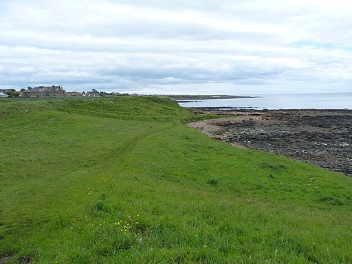
A grassy section of the path, south of Crail.

The Fife Coast path near Crail - geograph.org.uk - 3031293

The Fife Coast path near Crail

Crail Harbour - geograph.org.uk - 2153834

Crail Harbour

Video

GPS Files

GPX File

Anstruther to Crail.gpx (On Desktop:Right Click>'Save As. On Ipad/Iphone:Click and hold>Share>Save to Files')