Baildon Moor Circular Walk
![]()
![]() This large area of moorland near Bradford is a popular place for walkers and cyclists. There's miles of good trails and fantastic views of Leeds and Bradford from the elevated position of the moor.
This large area of moorland near Bradford is a popular place for walkers and cyclists. There's miles of good trails and fantastic views of Leeds and Bradford from the elevated position of the moor.
There's a good sized car park on Glovershaw Lane just to the north west of Baildon town centre. From here you can pick up numerous footpaths and bridleways suitable for mountain bikers. Head south from the car park and you can climb Baildon Hill which rises to a height of over 900ft. It's a great spot to soak up the far reaching views over the Yorkshire cities, towns and hills surrounding the moor.
To extend your walking in the area you can head south and visit the delightful Shipley Glen before picking up the towpath along the Leeds and Liverpool Canal. The lovely glen is right next to the moor and is well worth a visit with its pretty beck and woodland trails. It also includes the splendid Bracken Hall Countryside Centre which has a wealth of information on the area.
The River Aire also runs through nearby Shipley.
The Bradford Millennium Way and the Dales Way Link also run past the western fringe of the moor. Both these trails will take you to Bingley Moor and Ilkley Moor if you follow them north.
Just a few miles to the east at Guiseley you will find Esholt Woods which is another good place for walkers and mountain bikers.
Postcode
BD17 5LG - Please note: Postcode may be approximate for some rural locationsPlease click here for more information
Baildon Moor Ordnance Survey Map  - view and print off detailed OS map
Baildon Moor Open Street Map  - view and print off detailed map
*New* - Walks and Cycle Routes Near Me Map - Waymarked Routes and Mountain Bike Trails>>
Baildon Moor OS Map  - Mobile GPS OS Map with Location tracking
Baildon Moor Open Street Map  - Mobile GPS Map with Location tracking
Pubs/Cafes
Head into Baildon village on the eastern side of the moor and you could visit the Bulls Head Inn. The inn has an attractive interior with a tap room, log fires and old photos of Baildon adorning the walls. They serve good food which you can enjoy in the garden area on warmer days. You can find them at 6 Westgate with a postcode of BD17 5ES for your sat navs.
On the southern side of the moor there's also The Old Glen House, next to the popular Shipley Glen tramway. The historic pub is hundreds of years old and has a charmingly rustic interior with cosy log fires. They serve good home cooked food which you can also enjoy in the outdoor area on a sunny day. You can find them on Prod Lane at a postcode of BD17 5BN for your sat navs.
Dog Walking
The expansive moor is a great place to exercise your dog. Please keep them under control as there are grazing animals and lots of birdlife to be aware of on the site. The Bulls Head and the Old Glen House mentioned above are also dog friendly.
Further Information and Other Local Ideas
Head a few miles west of the moor and you could explore the splendid Bingley St Ives estate. There's 500 acres of woodland, parkland and gardens to enjoy here.
For more walking ideas in the area see the Yorkshire Dales Walks and the Nidderdale Walks pages.
Cycle Routes and Walking Routes Nearby
Photos
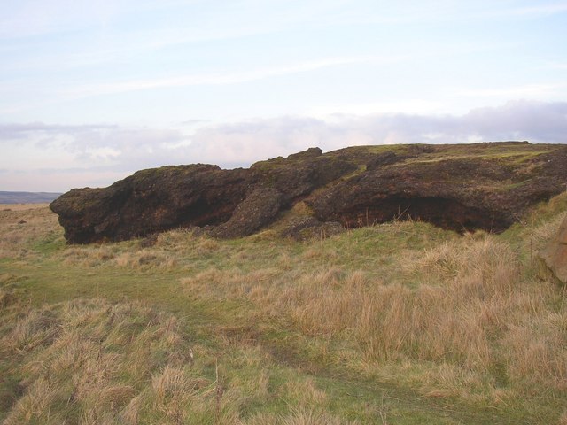
The cinder rocks. This view is from the south-west. Shallow caves have formed, similar to those found in lava.
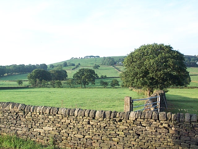
Summer house behind the Moor. This is one of a cluster of half a dozen such summer houses which presumably pre-date planning controls.


