Beachy Head Walk
![]()
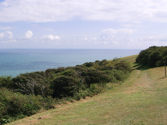
![]() This exhilarating walk takes you along the highest chalk sea cliff in Britain, at Beachy Head on the South Downs. The cliffs rise to a height of 162 metres (531 ft) with fabulous views along the coast to West Sussex and Dungeness in Kent.
This exhilarating walk takes you along the highest chalk sea cliff in Britain, at Beachy Head on the South Downs. The cliffs rise to a height of 162 metres (531 ft) with fabulous views along the coast to West Sussex and Dungeness in Kent.
You can start your walk from the good sized car park on Beachy Head Road which has a postcode of BN20 7YA for your sat navs. From here you can pick up the trails on to the The South Downs Way which will take you along the headland. You could also start the walk from the nearby town of Eastbourne and follow the Wealdway along the beach from the town centre. See our Eastbourne to Beachy Head Walk for details and a map.
As well as the magnificent views there's some lovely countryside to explore inland. Look out for lots of wildflowers in the summer and a variety of birdlife which includes Lapwing, Skylark and Perigrin Falcon.
After your walk you can enjoy refreshments at the Beachy Head cliff top pub which is next to the car park.
To extend your walk you can continue west along the coastal path to Birling Gap and the Belle Tout Lighthouse. Beyond there is the fantastic Seven Sisters Country Park at Cuckmere Haven. Here you will find more great cycling and walking trails along the coast and the River Cuckmere.
Postcode
BN20 7YA - Please note: Postcode may be approximate for some rural locationsBeachy Head Ordnance Survey Map  - view and print off detailed OS map
Beachy Head Open Street Map  - view and print off detailed map
*New* - Walks and Cycle Routes Near Me Map - Waymarked Routes and Mountain Bike Trails>>
Beachy Head OS Map  - Mobile GPS OS Map with Location tracking
Beachy Head Open Street Map  - Mobile GPS Map with Location tracking
Explore the Area with Google Street View 
Pubs/Cafes
The Beachy Head Inn is a conveniently located and aptly named place to go for some post walk refreshment. The pub dates back to 1880 and has a charming interior with cosy fires. Outside there's a good sized garden area with nice views of the surrounding South Downs countryside. You can find the pub a short hop from the car park on Beachy Head Road. The outdoor area is also dog friendly if you have your four legged friend with you.


Pictured above the Beachy Head Pub and countryside centre. Two worthy places to stop at on the route.
Further Information and Other Local Ideas
The site includes the Beachy Head Countryside Centre where there are some interesting exhibitions detailing the history of the area and the bravery of the people who have had to rescue people off the notorious cliffs. There's also a good gift shop and a gallery of photos of this stunning area. It's well worth popping in after your walk if you have time.
Cycle Routes and Walking Routes Nearby
Photos
Beachy Head and Lighthouse, East Sussex, England. The lighthouse is located in the English Channel below the cliffs. It was built to replace the nearby Belle Tout Lighthouse and became operational in 1902. For the construction, a temporary cable car from the cliff was installed for the transport of workers and stones to an iron ocean platform adjacent to the lighthouse.
Beachy Head, a geologically fascinating area. The chalk was formed in the Late Cretaceous epoch, between 66 and 100 million years ago, when the area was under the sea. Over millennia, the remains of countless marine organisms, primarily coccolithophores (microscopic algae), accumulated on the seabed to form chalk—a soft, white limestone.
The cliffs are an important habitat for seabirds, including kittiwakes, fulmars, and herring gulls. You may also spot the occasional peregrine falcon, a bird of prey that nests in the cliff faces. In the grasslands, skylarks and meadow pipits are commonly seen, their calls adding a lively soundtrack to the area.
Butterflies are abundant during warmer months, with species such as the chalkhill blue, small skipper, and marbled white frequently spotted. The grassy areas also provide a home for small mammals like voles and hares, and you might even glimpse a fox or badger at dawn or dusk.
A view to the south from last stretch of South Downs Way before reaching Beachy Head. The chalk grasslands around Beachy Head are rich in wildflowers, especially in spring and summer. Orchids like the pyramidal orchid and the common spotted orchid thrive here, alongside species such as horseshoe vetch, bird’s-foot trefoil, and thrift, which add vibrant colours to the landscape. These plants are well-suited to the nutrient-poor chalk soils and play a key role in supporting the area’s biodiversity.
Memorials at the headland. The clifftops of Beachy Head provide sobering memorials to some of the despairing people who have leapt over the edge. The Samaritans organisation is heavily advertised to try and prevent these tragedies.
Looking towards the eastern end of the range. The changing nature of the beach is clearly visible here, piles of rocks followed by smoothed out ledges. The two people in the distance are on a crabbing expedition.
The coastal waters below Beachy Head are rich with marine life, and on calm days, you might spot seals or even a pod of dolphins passing by. The area's unique combination of chalk cliffs, grasslands, and ocean creates a thriving ecosystem worth exploring.
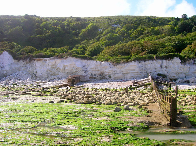
Cliffs at Holywell. Near to the steps to the beach and taken at low tide next to the western most groyne along Eastbourne's seafront. The cliffs behind have 'slumped' due to landslides, a feature of the cliffline between Holywell and Cow Gap.


