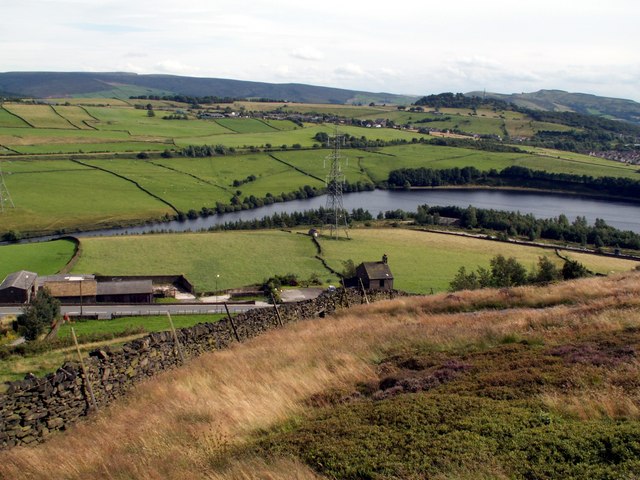
Bottoms Reservoir Tintwistle Walk
![]()
![]() Enjoy an easy circular walk around this pretty reservoir in the Peak District. There's a nice footpath running around the lake with fine views along the way.
Enjoy an easy circular walk around this pretty reservoir in the Peak District. There's a nice footpath running around the lake with fine views along the way.
The walk starts from the little village of Tintwistle which is located just to the north of the water. From here you can pick up the Etherow Goyt Valley Way and following along the reservoir. It's about a 1.5 mile walk around the perimeter so it should take around 30-45 minutes. On the way there's fine views across the water to the surrounding woodland, hills and countryside.
The Longdendale Trail runs past the southern end of the reservoir. This shared cycling and walking trail is a great way to extend your outing. You could follow it east and visit Valehouse and Torside Reservoir.
Postcode
SK13 1HS - Please note: Postcode may be approximate for some rural locationsBottoms Reservoir Ordnance Survey Map  - view and print off detailed OS map
Bottoms Reservoir Open Street Map  - view and print off detailed map
Bottoms Reservoir OS Map  - Mobile GPS OS Map with Location tracking
Bottoms Reservoir Open Street Map  - Mobile GPS Map with Location tracking
Pubs/Cafes
The historic Bull's Head is conveniently located in Tintwistle. The 16th century pub does very good food and has a nice cosy fire for winter days. You can easily find the pub in the village at a postcode of SK13 1JY for your sat navs. It's also very dog friendly if you have your canine friend with you.
Further Information and Other Local Ideas
Bottoms Reservoir was constructed between 1865 and 1877, by John Frederick Bateman as part of the Longdendale chain to supply water from the River Etherow to the urban areas of Greater Manchester. It's part of a number of reservoirs in this interesting area of the Peak District.
Arnfield Reservoir is located just to the west and has a nice walking trail to try. Our walk takes you along the eastern edge of the reservoir before visiting the nearby Hollingworth Nature Reserve.
For more walking ideas in the area see the Peak District Walks page.


