Holyhead Breakwater Country Park
![]()
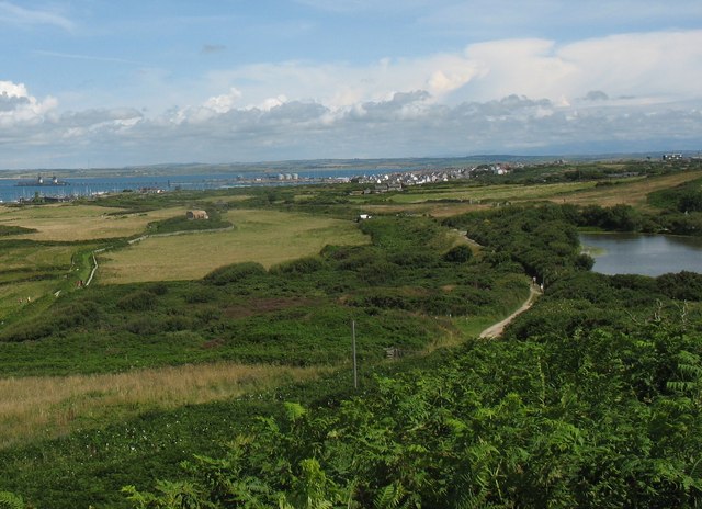
![]() Enjoy over 100 acres of coastal country park on this walking route in Holyhead, Anglesey. There are fabulous views of Holyhead Mountain, the Irish Sea and the Skerries - a group of offshore islands about 7 miles from the coast. The park includes a nature trail, various other footpaths, a visitor centre and good parking facilities.
Enjoy over 100 acres of coastal country park on this walking route in Holyhead, Anglesey. There are fabulous views of Holyhead Mountain, the Irish Sea and the Skerries - a group of offshore islands about 7 miles from the coast. The park includes a nature trail, various other footpaths, a visitor centre and good parking facilities.
The Anglesey Coast Path runs through the park so there is scope for continuing your walk along the coast in either direction. Just along the coast you will come to the spectacular South Stack Lighthouse. Here you can descend the 400 steps to the island and enjoy fabulous views on the way. The area also includes the South Stack RSPB nature reserve where you can look out for puffins and porpoises.
If you head in the other direction through Holyhead you will soon come to the lovely Penrhos Beach and Penrhos Coastal Park.
The park has lovely coastal views and waymarked nature trails where you can look out for the resident red squirrels.
Postcode
LL65 1YG - Please note: Postcode may be approximate for some rural locationsPlease click here for more information
Breakwater Country Park Ordnance Survey Map  - view and print off detailed OS map
Breakwater Country Park Open Street Map  - view and print off detailed map
Breakwater Country Park OS Map  - Mobile GPS OS Map with Location tracking
Breakwater Country Park Open Street Map  - Mobile GPS Map with Location tracking
Explore the Area with Google Street View 
Pubs/Cafes
After your walk head to Caffir Park in the Park. They've converted the old warden’s house at the Park into a lovely cafe. There's hot or cold meals and a nice outdoor seating area with views of the park. You can find the cafe just to the south of the lake, near the entrance to the park.
Dog Walking
The park is a great place to come for a dog walk. You'll probably see other owners on a fine day. The on site cafe mentioned above is also dog friendly.
Further Information and Other Local Ideas
Near to the South Stack car park at the foot of the south western side of the mountain you will find the interesting Ty Mawr Hut Circles. Also known as Cytiau'r Gwyddelod or the Irishmen's Huts, they are the remains of a group of prehistoric huts and one of the best-preserved hut groups in Wales. The settlement is to the southeast of the South Stack Lighthouse, on the opposite side of the road from the small car park provided by the Royal Society for the Protection of Birds. It's well worth a visit if you have time after your walk.
Cycle Routes and Walking Routes Nearby
Photos
View eastwards towards Pwll Clai. This flooded clay pit is now a fishing lake. The former WWII battery can be seen on the left of the image.


