Brecon Beacons Waterfall Walk
![]()
![]() A long circular walk visiting several of the National Park's wonderful waterfalls. The route visits the famous Four Waterfalls and the lovely Neath Waterfalls with nice woodland trails and fine views of the surrounding mountains to enjoy.
A long circular walk visiting several of the National Park's wonderful waterfalls. The route visits the famous Four Waterfalls and the lovely Neath Waterfalls with nice woodland trails and fine views of the surrounding mountains to enjoy.
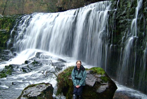
Start the walk from the Gwaun Hepste car park near Ystradfellte. It's a good sized parking area which also includes a picnic area. From here you pick up the woodland trails heading south west to visit the first waterfall of Sgwd Uchaf Clyn Glyn. The paths continue south along the Afon Mellte to Sgwd Isaf Clun-Gwyn, the lower of the Clyn Glyn falls. Further south you will come to Sgwd yr Eira, probably the most photographed waterfall in the Brecon Beacons because you can actually walk behind the curtain of thundering water.
The route then heads south west through the woodland to reach the village of Pontneddfechan. There's more beautiful waterfalls to see here as you head north from the village along the Afon Nedd Fechan and the Afon Pyrddin, upland tributaries of the River Neath. You'll pass the Sgwd Gwladus and Sgwd Ddwli falls as you make your way through this lovely section of Waterfall Country. The first is known as 'Lady's Falls' and are formed where the Afon Pyrddin drops 20 ft (6 m) over a lip of the 'Twelve Foot Sandstone'. The lady in question was one of the daughters of Brychan, the 5th-century King of Brycheinog. The sandstone tilts gently to the south so forcing the waters of the Pyrddin up against the foot of a high cliff of mudstone and over the left-hand side of the rock lip.
After emerging from the woods, the final section crosses countryside to return to the Afon Mellte. From here it is a short walk back to the car park and the finish point of the route.
To continue your waterfall walking in the area head to the wonderful a Aberdulais Falls and Melincourt Falls.
Brecon Beacons Waterfall Walk Ordnance Survey Map  - view and print off detailed OS map
Brecon Beacons Waterfall Walk Open Street Map  - view and print off detailed map
Brecon Beacons Waterfall Walk OS Map  - Mobile GPS OS Map with Location tracking
Brecon Beacons Waterfall Walk Open Street Map  - Mobile GPS Map with Location tracking
Cycle Routes and Walking Routes Nearby
Photos
Sgŵd Uchaf Clyn Glyn. This is the upper of the two Clyn Glyn waterfalls as seen from above on the west river bank walk.
Sgwd yr Eira, probably the most photographed waterfall in the Brecon Beacons because you can actually walk behind the curtain of thundering water. Though not the biggest of the falls, I think it was my favourite for its setting in the beautiful landscape.
The Waterfalls Centre, main building centre right, provides information on the waterfalls of the River Neath tributaries, Brecon Beacons National Park and the Fforest Fawr Geopark. In the foreground is the boundary marker for the National Park and the boundary between Powys and Neath Port Talbot. On the extreme left is the historic Angel Inn, Pontneddfechan.
Scwd Ddwli falls. One of six waterfalls on the Nedd Fechan river which we combined with the 4 waterfalls walk from just south of Ystradfellte. They were quite a spectacle following heavy rain, and combining this with the cave below the car park at SN928124 made for a great day.


