Bronte Waterfall and Top Withens
![]()
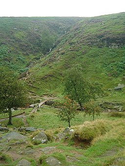
![]() Visit these two landmarks associated with the Bronte sisters on this delightful literary walk in West Yorkshire. The two sites can be reached from Haworth which is just a few miles east of the falls. The area known as Bronte Country is exceptionally beautiful with flowing becks, attractive moorland scenery and great views of the Pennine Hills. It is quite a challenging walk climbing to a height of over 1300ft on the high points.
Visit these two landmarks associated with the Bronte sisters on this delightful literary walk in West Yorkshire. The two sites can be reached from Haworth which is just a few miles east of the falls. The area known as Bronte Country is exceptionally beautiful with flowing becks, attractive moorland scenery and great views of the Pennine Hills. It is quite a challenging walk climbing to a height of over 1300ft on the high points.
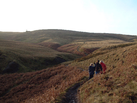
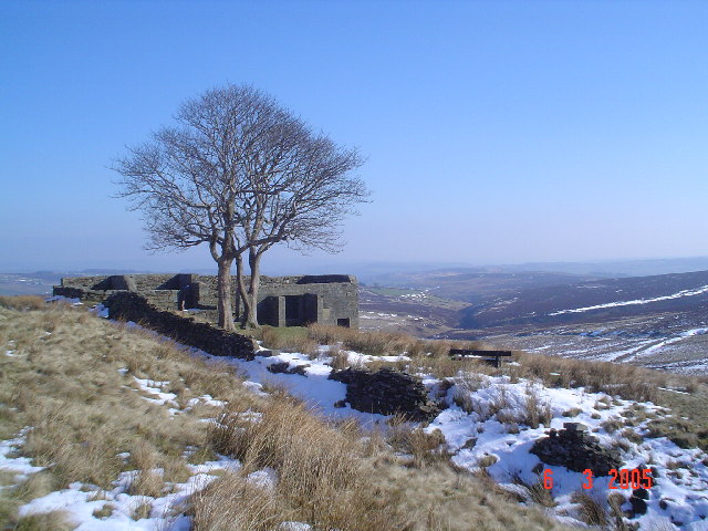
The walk starts from the town of Haworth at the church in the centre of the town. There is a parking area close by and the train station is also just a few minutes stroll away. From the church you can pick up the Bronte Way to to take you through Penistone Hill Country Park. The 179 acre park consists of lovely undulating grass and heather moorland with fabulous views over the area. The path then continues across Haworth Moor to the falls. The picturesque spot was a favourite of the sisters, who would often spend time contemplating at the falls. After enjoying the beautiful spot the walk continues south west to the ruined farmhouse of Top Withens, said to have been the inspiration for Wuthering Heights.
The route then follows a section of the Pennine Way over Stanbury Moor, passing Withins Slack and Flaight Hill before rejoining the Bronte Way. On the return leg you can take a small detour to visit Lower Laithe Reservoir if you have time.
To extend your walking in the area you could pick up the Pennine Way and visit Watersheddles Reservoir and Ponden Reservoir which is located just north of the falls.
Here you will find Ponden Hall said to be the inspiration for Thrushcross Grange, the home of the Linton family in Wuthering Heights.
Postcode
BD22 8DR - Please note: Postcode may be approximate for some rural locationsBronte Waterfall and Top Withens Ordnance Survey Map  - view and print off detailed OS map
Bronte Waterfall and Top Withens Open Street Map  - view and print off detailed map
Bronte Waterfall and Top Withens OS Map  - Mobile GPS OS Map with Location tracking
Bronte Waterfall and Top Withens Open Street Map  - Mobile GPS Map with Location tracking
Pubs/Cafes
To the north of the falls there's a few good options for refreshments on the walk. Ponden Mill has a nice cafe set in a historic Georgian Cotton Mill. The riverside mill is in a great location and has a good selection of cakes to try. You can find it on Ponden Lane at postcode BD22 0HP for your sat navs. After your meal you could then enjoy a stroll around the adjacent Ponden Reservoir.
Just up the road from here is the Old Silent Inn which does great food and also provides accommodation. You can find it on Hob Lane at postcode BD22 0HW.
Also in Stanbury is the aptly named Wuthering Heights. This pub has a fine beer garden with great views over the surrounding countryside. It's on the Main Street in the village at postcode BD22 0HB.
Dog Walking
The area is great for dog walking though you are advised to keep them on leads in this area as there are lots of grazing animals. The Wuthering Heights pub and the Old Silent Inn mentioned above are also dog friendly.
Cycle Routes and Walking Routes Nearby
Photos
Bridge and falls view. Even in the height of summer, it poured down all day and we spent most of the circular walk from Haworth to Top Withens actually in the cloud! This view of the falls was probably worth getting soaked to the skin for.
Springs Farm, Enfield Side. This is the elevation overlooking the reservoir. The Millennium Way footpath to the Bronte Waterfalls runs along Enfield Side Road behind it.


