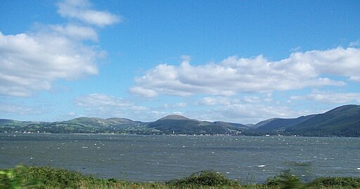
Carlingford Lough and Slieve Foye Mountain Loop Walk
![]() This walk in County Louth visits Carlingford lough before a climb to the viewpoint at Slieve Foye.
This walk in County Louth visits Carlingford lough before a climb to the viewpoint at Slieve Foye.
You can start the walk in the town of Carlingford on the shores of the lake. From here you can follow tracks heading north west and then south to reach the 589 metre summit of Slieve Foye. At the summit you can enjoy some wonderful views over the lake to the surrounding hills and mountains.
The walk then continues south to Barnavave before descending back to the town and the lake.
The area is great for wildlife watching with pale-bellied brent goose to look out for around the saltmarsh and terns to see around the shingle islands.
Carlingford is notable as one of only 3 glacial fjords in Ireland with the others being Lough Swilly and Killary Fjord.
To continue your walking in the area head south to pick up the Cooley Peninsula Walk at Gyles' Quay. There's a pretty beach and fine views of Dundalk Bay and the Mourne Mountains here.
Carlingford Lough and Slieve Foye Mountain Loop Open Street Map  - view and print off detailed map
Ireland Walking Map - View All the Routes in the Country>>
Carlingford Lough and Slieve Foye Mountain Loop Open Street Map  - Mobile GPS Map with Location tracking
Further Information and Other Local Ideas
The Mourne Way long distance trail starts at Rostrevor on the opposite side of the lake. The epic trail will take you through the stunning Mourne Mountains Area of Outstanding Natural Beauty.
Photos
The waters of Carlingford Lough from Carlingford Harbour. Carlingford is the main town on the Cooley Peninsula. It retains its medieval layout noticeable by the narrow lanes and small streets. Tholsel Street is where the last of the medieval walled town's gates can still be seen, called "The Tholsel" which apparently was also used as a gaol, on Tholsel Street itself there is still a 16th-century Town House known as the Carlingford Mint.
Carlingford is dominated by Slieve Foye and its (slightly) smaller sister Carlingford Mountain. This is the latter seen from the harbour. The white object, at top right, is the moon. The area has been a tourist destination since Victorian times when the railway between Dublin and Belfast was opened. Situated approximately halfway between the two cities, the access to the area combined with its scenery and sheltered location are still factors in its popularity today.


