Carlton in Cleveland Walks
![]()
![]() This village in North Yorkshire sits in a fine spot on the edge of the North York Moors National Park.
This village in North Yorkshire sits in a fine spot on the edge of the North York Moors National Park.
This circular walk visits some of the local highlights including Lord Stones Country Park, Carlton Bank viewpoint, Whorl Hill Wood and the neighbouring village of Faceby. Much of the route uses a section of the Cleveland Way National Trail which runs through the area.
The walk starts in the village and follows footpaths east to Cote House where you turn south to the Lord Stones Park. Here you can pick up the Clevaland Way and follow it up to the viewpoint on Cringle Moor.
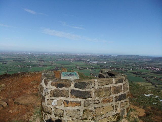
You then head west to explore Carlton Moor, climbing to the high point at Carlton Bank where there are some excellent views back to the village.
You continue west to Faceby Bank, Gold Hill and Round Hill before turning north near Heathwaite. You then head north to visit Whorl Hill where there are some peaceful woodland trails.
The route then heads through Faceby village before following public footpaths east to return to Carlton in Cleveland.
Postcode
TS9 7DJ - Please note: Postcode may be approximate for some rural locationsCarlton in Cleveland Ordnance Survey Map  - view and print off detailed OS map
Carlton in Cleveland Open Street Map  - view and print off detailed map
Carlton in Cleveland OS Map  - Mobile GPS OS Map with Location tracking
Carlton in Cleveland Open Street Map  - Mobile GPS Map with Location tracking
Walks near Carlton in Cleveland
- Swainby - This little village is located in a nice position at the north-western corner of the North York Moors National Park
- Osmotherley - The North Yorkshire village of Osmotherley is situated on the western edge of the North York Moors National Park in the Hambleton Hills
- Cod Beck Reservoir - Enjoy a short walk around this pretty reservoir on the western edge of the North York Moors near Osmotherley
- Hambleton Hills - This walk explores the Hambleton Hills range on the western edge of the North York Moors
- Lyke Wake Walk - The Lyke Wake Walk is a complete crossing of the North Yorkshire Moors from west to east
- Lord Stones - Visit this ancient stone and enjoy fabulous views from Cringle Moor on this exhilirating circular walk on the North York Moors
- Wainstones - Climb Hasty Bank Hill and visit the fascinating Wainstones on this circular walk in the North York Moors
- Silton Forest - Enjoy miles of mountain bike trails and footpaths in this large coniferous forest on the North York Moors
- Penshaw Monument - Climb Penshaw Hill and visit this iconic Sunderland landmark on this short walk in Tyne and Wear
- Roseberry Topping - Climb to the summit of this distinctive hill near Guisborough and enjoy wonderful views across the beautiful North York Moors National Park
- Ingleborough Mountain - This walk climbs to Ingleborough, one of Yorshire's Three Peaks, standing at a height of 723 metres (2,372 ft)
- Whernside - Climb to the highest point in North Yorkshire on this challenging circular walk in the Yorkshire Dales
- Captain Cook's Monument - Enjoy a walk from Great Ayton to this iconic landmark on Easby Moor
- Carlton Bank - This walk climbs to Carlton Bank on Carlton Moor in the North York Moors National Park.
Pubs/Cafes
Back in the village you can enjoy some post walk refreshment at the Blackwell Ox. They serve some delicious Thai cuisine and also provide holiday lodges. You can find them at postcode TS9 7DJ for your sat navs.


