Coleshill Circular Walk with OS Map
![]()
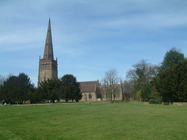
![]() This Warwickshire based market town has some nice river and country trails for walkers to try. The historic town centre is also a pleasant place for a stroll with a number of noteworthy old buildings. These include several old coaching houses and the 12th century Church of St Peter St Paul at the top of the Market Square.
This Warwickshire based market town has some nice river and country trails for walkers to try. The historic town centre is also a pleasant place for a stroll with a number of noteworthy old buildings. These include several old coaching houses and the 12th century Church of St Peter St Paul at the top of the Market Square.
This circular walk from the town visits some of the local highlights including the Cole End nature reserve and the lovely Shustoke Reservoir. It also makes use of one of the local waymarked footpaths in the shape of the Heart of England Way.
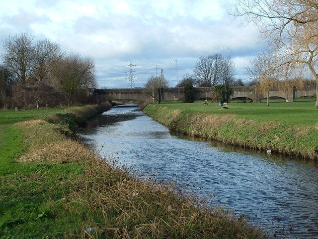
The walk starts in the town centre and follows country lanes north east out of the town. On this section you can follow a footpath north to visit the Cole End Park Nature Reserve. There's lots of interesting wildlife and plantlife to see on the site, which is located on the River Cole on the northern side of the town. You then continue east on the Blythe Road before following a public footpath through the countryside to Shustoke. Here you pass through the little village before following a circular trail around the picturesque lake. At the eastern end of the water you pick up the Heart of England Way and follow the trail south to Dover House Farm and Dumble Wood. Here you turn west to follow a trail past the Maxstoke golf course and the Pooltail woodland plantation before crossing the River Cole and returning to the town.
Coleshill Ordnance Survey Map  - view and print off detailed OS map
Coleshill Open Street Map  - view and print off detailed map
*New* - Walks and Cycle Routes Near Me Map - Waymarked Routes and Mountain Bike Trails>>
Coleshill OS Map  - Mobile GPS OS Map with Location tracking
Coleshill Open Street Map  - Mobile GPS Map with Location tracking
Pubs/Cafes
The Green Man is easily found on the High Street. The real ale pub also has an outdoor area if the weather is good. You can find them at 68 High St, B46 3AH.
The George & Dragon is located in the town centre. They serve good quality food and have a nice garden area for warmer days. You can find them at 154 Coventry Rd with a postcode of B46 3EH for your sat navs.
Dog Walking
The country and river trails make for a fine dog walk. The Green Man and the George & Dragon mentioned above are also dog friendly.
Further Information and Other Local Ideas
Near the reservoir you can also pick up the epic Warwickshire Centenary Way to explore the surrounding countryside. You could follow it north to vist Whiteacre Heath and the splendid Kingsbury Water Park where there are a series of popular waterside trails to try. You can also pick up the towpath of the Birmingham and Fazeley Canal in this area.
For more walking ideas in the area see the Warwickshire Walks page.
Cycle Routes and Walking Routes Nearby
Photos
River Cole in the Cole End Nature Reserve. A nice place for an easy stroll on the outskirts of the town.


