Crammel Linn Waterfall Walk
![]()
![]() This walk visits the lovely Crammel Linn waterfall near Gilsland on the border between Cumbria and Northumberland. The picturesque spot is something of a hidden gem and a popular place for walks, picnics and swimming.
This walk visits the lovely Crammel Linn waterfall near Gilsland on the border between Cumbria and Northumberland. The picturesque spot is something of a hidden gem and a popular place for walks, picnics and swimming.
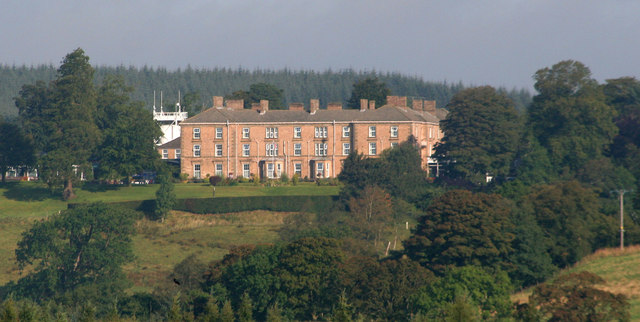
You can start the walk at the Gilsland Hall Hotel in the village. Then follow a footpath north along the River Irthing, passing the Popping Stone and Collering Woods. After just under 2 miles you will come to the photogenic Crammel Linn waterfall. The waterfall is 7.6 metre (25 ft) high and looks impressive after rain. The scenic river gorge is also good for wildlife spotting with Peregrine falcons nesting in the trees and cliff. Deer can also sometimes be seen roaming in the forested areas.
The path along the river can be muddy in wetter months so it is advisable to bring a good pair of walking shoes.
For more information on geography and history of the surrounding area see wikipedia's River Irthing page.
Postcode
CA8 7AR - Please note: Postcode may be approximate for some rural locationsCrammel Linn Waterfall Walk Ordnance Survey Map  - view and print off detailed OS map
Crammel Linn Waterfall Walk Open Street Map  - view and print off detailed map
Crammel Linn Waterfall Walk OS Map  - Mobile GPS OS Map with Location tracking
Crammel Linn Waterfall Walk Open Street Map  - Mobile GPS Map with Location tracking
Pubs/Cafes
You can enjoy refreshments back at the Gilsland Hotel. The Galloways Bar serves a good range of meals and snacks to non residents.
Dog Walking
The river path is a nice one to do with your dog. There's also miles of good woodland trails on Waterhead Common just to the west of the river.
Further Information and Other Local Ideas
Just a mile to the south of Gilsland you can pick up the epic Hadrian's Wall Path and visit the fascinating Birdoswald Roman Fort. The fort is the most impressive of the remaining defences along the Wall today. Housesteads fort with its visitor centre and museum is a little further away to the east. On the way you would also find the remains of Thirlwall Castle which lies just over a mile east of Gilsland, near Greenhead village. The castle dates back to the 14th century and is well worth of a visit for its historical significance.
If you head a few miles west along the wall there's another historic local highlight at Lanercost Priory. The English heritage run site was originally founded in 1169 as an Augustinian monastery. Today the substantial priory ruins are well worth a visit for the fascinating history and architecure.
For more walks in the area see the North Pennines Walks and Northumberland National Park Walks pages.
Cycle Routes and Walking Routes Nearby
Photos
River Irthing just north of Gilsland. Along the way, the flora reflects a mix of habitats, from woodland to riverside vegetation. In the woodlands, trees like oak, birch, and rowan dominate, with undergrowth featuring ferns, mosses, and wildflowers such as bluebells and wood anemones in spring. Near the riverbanks, reed grasses and water-loving plants like marsh marigolds and yellow flag irises thrive. On the drier slopes, you may find heather and gorse, adding splashes of colour during their blooming seasons.
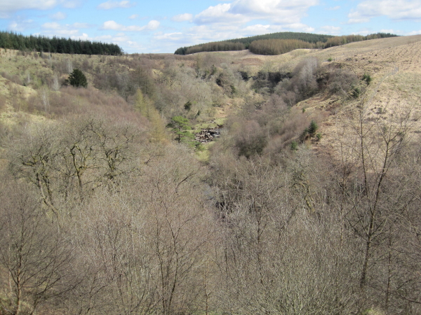
River Irthing Gorge below Crammel Linn. The fauna includes a variety of birdlife, such as dippers and grey wagtails, which frequent the fast-flowing waters of the Irthing. Buzzards and kestrels are often seen soaring above, while kingfishers might dart along the river. The woodland is home to small mammals like red squirrels and hedgehogs, and you might catch a glimpse of deer in the more secluded areas. Amphibians such as frogs and newts can be spotted near wetter sections of the trail, while the river itself supports fish like brown trout.
Rocks on the bank of the River Irthing below Crammel Linn. The River Irthing, which flows through the Crammel Linn area, originates in the Borderlands and eventually joins the River Eden. It’s known for its clean, fast-moving waters and its historical significance, having formed part of the ancient natural boundaries of the region. The river is lined with sandstone cliffs in places, creating picturesque scenery and providing habitats for numerous species of wildlife.
The waterfall at Crammel Linn, particularly after heavy rain, is a striking sight, with water tumbling over sandstone rocks into a deep pool below. This area is also near Hadrian’s Wall, which offers a connection to Roman history, adding a layer of cultural interest to the scenic landscape.


