Cuckoo Trail
![]()
![]() This traffic free cycle and walking path runs along a disused railway line from Heathfield to the outskirts of Eastbourne.
This traffic free cycle and walking path runs along a disused railway line from Heathfield to the outskirts of Eastbourne.
The trail follows National Cycle Route 21 for about 14 miles and runs through a mixture of woodland, grassland and countryside with a variety of interesting sculptures lining the way. It begins in the East Sussex market town of Heathfield and finishes near the beautiful coastline at Eastbourne.
For wildlife lovers there is plenty to look out for along the trail including different species of butterflies such as the orange-tip. Also look out for various birdlife including bullfinch, lesser whitethroat and cuckoos of course (The trail obtained its name from the tradition that the first cuckoo in Spring was heard at the Heathfield Fair).
The trail is easily accessible with train stations at Polegate and Hampden Park. It is also a nice easy, safe route ideal for families.
Please click here for more information
Cuckoo Trail Ordnance Survey Map  - view and print off detailed OS map
Cuckoo Trail Open Street Map  - view and print off detailed map
Cuckoo Trail OS Map  - Mobile GPS OS Map with Location tracking
Cuckoo Trail Open Street Map  - Mobile GPS Map with Location tracking
Cycle Routes and Walking Routes Nearby
Photos

Browning Road, Heathfield. Site of Heathfield's former station, the old station building can still be seen in the centre of the picture behind the trees. This is also the current northernmost point of the Cuckoo Trail.

Unnamed Lake near the trail, east of Marle Green. The lake is to the east of the trail near the bottom of the grid square. The trees are a small extension of Wicker Wood.

Woodhams Bridge. Carrying a farm track over the former railway line. The carved seat in the foreground is one of many that can be found throughout the length of the trail depicting local wildlife, flora and fauna.
.jpg)
25-1/2 mile post on Cuckoo Line. The mileage was measured, unusually, towards London, the 24-1/2 milepost being at Hellingly station (which helped in locating this), and datum at Brighton station.

Shawpits Bridge, near Hellingly. This bridge carries the farm track from Shawpits Farm to the A267 over the former railway line now the Cuckoo Trail. This view looks north.

A dog on the trail near Hellingly station.

Between Polegate and Hailsham. Looking south between Summerhill Lane and Mulbrooks Farm.

Start/End of the trail, School Lane, Polegate. The trail is named after the tradition of releasing a Cuckoo at the start of the Heathfield (or Heffle) Fair. The trail runs from Polegate to Heathfield, a distance of 11 miles and runs along the old railway line which closed in 1968. This is the start/end of the trail which was opened in September 1992.
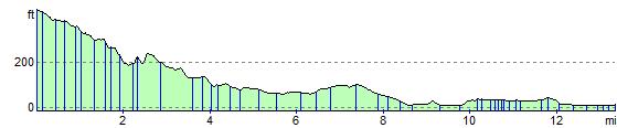
Elevation Profile