Dancing Ledge
![]()
![]() Visit this lovely area of the Dorset coast on this circular walk to Dancing Ledge. The walk starts at the car park in the pretty village of Langton Matravers and descends to the coast through some attractive countryside. Dancing Ledge is so called because when the waves wash over the surface of the rocks it appears as the the ledge is 'dancing'. It's a very pretty spot with lovely views down the coast and the option of continuing to Seacombe Cliff and the nearby village of Worth Matravers.
Visit this lovely area of the Dorset coast on this circular walk to Dancing Ledge. The walk starts at the car park in the pretty village of Langton Matravers and descends to the coast through some attractive countryside. Dancing Ledge is so called because when the waves wash over the surface of the rocks it appears as the the ledge is 'dancing'. It's a very pretty spot with lovely views down the coast and the option of continuing to Seacombe Cliff and the nearby village of Worth Matravers.
To extend your walk you could pick up the South West Coast Path and head east towards Swanage and Durlston Country Park. Our Purbeck Circular Walk also passes the site so you could pick this up and explore the beautiful Isle of Purbeck.
Postcode
BH19 3LD - Please note: Postcode may be approximate for some rural locationsDancing Ledge Ordnance Survey Map  - view and print off detailed OS map
Dancing Ledge Open Street Map  - view and print off detailed map
Dancing Ledge OS Map  - Mobile GPS OS Map with Location tracking
Dancing Ledge Open Street Map  - Mobile GPS Map with Location tracking
Pubs/Cafes
Back in Langton Matravers you could enjoy some post walk refreshment in The Kings Arms. They serve good quality food which you can enjoy in the sun trap garden during the warmer months. You can find them on the High Street at postcode BH19 3HA for your sat navs.
Dog Walking
The country and coastal trails make for a bracing dog walk. The Kings Arms mentioned above is also dog friendly.
Cycle Routes and Walking Routes Nearby
Photos

The ledge viewed from the west. Looking east across Dancing Ledge from the edge of the old quarry floor. There are no beaches on this stretch of concordant coastline and this is one location where people can get down to sea level (after a scramble down the short cliff onto the gently sloping ledge). Just beyond the ledge is Green Point where a waterfall trickles down at a fault and the cliff is bright green with moss and algae.

Limestone grassland above Dancing Ledge. This part of the Purbeck coastline is managed by the National Trust.

Quarry spoil. Looking down on to the floor of the disused quarry.

Steps descending into the quarry

Footpath to Langton Matravers from the Priest's Way. This footpath leads straight to Garfield Lane in Langton Matravers, past Tom's Field campsite (on the left). The walkers are headed in the opposite direction to the Priest's Way on the limestone plateau.

Horses grazing near Blackers Hole

Footpath heading North to Langton Matravers

Small quarry near Spyway Barn. The barn is National Trust owned and contains information boards telling you about the walks and conservation works in the area.
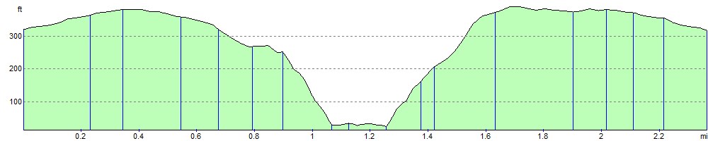
Elevation Profile