Deeside Way Railway Walk - Aberdeen to Ballater - Route 195
![]()
![]() This shared cycling and walking trail runs along a disused railway line from Aberdeen to Ballater, in the Cairngorms.
This shared cycling and walking trail runs along a disused railway line from Aberdeen to Ballater, in the Cairngorms.
It is also known as National Cycle Route 195.
The route starts in the city of Aberdeen on the northern side of Duthie Park. You then head west to Peterculter, Drumoak and Banchory where there's a nice run along the River Dee.
You cross the river here and continue west through the Blackhall Forest where there are some good mountain bike trails. The route then turns north west to Kincardine O' Neil where you will pass through Dess Wood. You could take a small detour here to visit the secluded Dess Waterfall.
The trail continues west passing the Loch of Aboyne and Loch Kinord before following the River Dee into Ballater.
Please click here for more information
Deeside Way Ordnance Survey Map  - view and print off detailed OS map
Deeside Way Open Street Map  - view and print off detailed map
*New* - Walks and Cycle Routes Near Me Map - Waymarked Routes and Mountain Bike Trails>>
Deeside Way OS Map  - Mobile GPS OS Map with Location tracking
Deeside Way Open Street Map  - Mobile GPS Map with Location tracking
Further Information and Other Local Ideas
For more walking ideas in the area see the Cairngorms Walks page.
Cycle Routes and Walking Routes Nearby
Photos
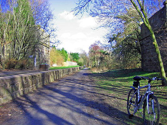
The old Culter Station on the Deeside Way. The railway which ran from Aberdeen to Banchory (and eventually on to Ballater) was opened in 1853 and closed in 1966; the station at Culter was the last on the line to be closed. The trackbed was restored in 2006 as the Deeside Way.
Beyond the wooded sections, the trail also passes through agricultural landscapes and open moorlands. These areas provide habitat for typical upland birds such as red grouse and, during certain seasons, can be a good place to spot raptors including hen harriers and even the occasional golden eagle soaring above open fields.
Near Nether Park. The Deeside Way closely follows the River Dee for significant stretches. The river’s banks support a variety of riparian vegetation and are important habitats for aquatic and semi–aquatic wildlife. Anglers and nature enthusiasts in the area often note sightings of species like Atlantic salmon and, in quieter moments, even otters. Water birds—such as dippers and kingfishers—can often be seen darting along the water’s edge.
The old railway station for Peterculter, the remains of a dismantled road bridge can be seen on either side, the route is now a popular walk/cycle way.
The diverse habitats along the route support an array of invertebrates—from butterflies and bees flitting among wildflowers to the less-visible, but equally important, ground-dwelling species. In the Caledonian forest fragments and along the river margins, you might notice the delicate blooms of native plants like twinflower and creeping lady’s-tresses, which in turn support local insect populations.
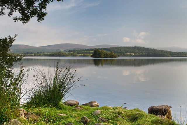
Loch Kinord. Loch Kinord and the nearby Loch Davan were both formed when the last glaciers melted here more than 10.000 years ago. They are textbook examples of kettle holes. These were formed when large blocks of ice became separated from the melting glacier and were buried by sand and gravel. When that ice finally melted, the sand and gravel that once lay on top of the ice collapsed, leaving a hollow (kettle hole) on the ground surface which later filled with water. The lochs are relatively shallow. Loch Kinord has an average depth of about 2 metres. The shallow depth means that light can penetrate to the loch floor. Consequently, the loch has a rich flora with many species of aquatic plants recorded.
The Deeside Way at Aboyne. As you move away from the urban setting of Aberdeen and into the more rural and wooded areas along the River Dee, you encounter a mosaic of habitats that support a diverse range of plant and animal species. In parts of the route—especially near areas like Drumoak and further along toward Banchory—the trail skirts remnants of Scotland’s native Caledonian woodlands. These areas are often dominated by Scots pine, with interspersed birch, rowan, and alder. Understory plants may include species such as heather and various wildflowers that add seasonal color to the landscape.


