Dinas Powys Walks
![]()
![]() This village (also known as Dinas Powis) is located a few miles from Cardiff in the Vale of Glamorgan. It's an attractive village with a number of listed buildings, some peaceful local woods and a river running through it. The village has a nice rural feel and includes a large village common and some nice pubs. This makes it a popular day trip for people coming from Cardiff.
This village (also known as Dinas Powis) is located a few miles from Cardiff in the Vale of Glamorgan. It's an attractive village with a number of listed buildings, some peaceful local woods and a river running through it. The village has a nice rural feel and includes a large village common and some nice pubs. This makes it a popular day trip for people coming from Cardiff.
This circular walk from the village visits Dinas Powys Woods, the neighbouring village of Michelston-le-Pit and the Cadoxton River at Cwrt-yr-ala.
The walk starts in the village, near to the train station. From here you pick up footpaths heading north through the woods to the river. Here you can see the Salmon Leaps, soome pretty lakes and a series of rushing weirs. The route then heads east to visit the little village of Michelston-le-Pit. The village is built near the confluence of two small streams, which join to form the Cadoxton River.
From here you head south, following the river back to the village, passing the remains of the castle on the way.
Dinas Powys Ordnance Survey Map  - view and print off detailed OS map
Dinas Powys Open Street Map  - view and print off detailed map
Dinas Powys OS Map  - Mobile GPS OS Map with Location tracking
Dinas Powys Open Street Map  - Mobile GPS Map with Location tracking
Pubs/Cafes
Head to the Star Inn for some post walk refreshments. They do good food and have a nice cosy interior with a log fire. There's also an outdoor area if the weather is good. You can find them on Station Road with a postcode of CF64 4DE for your sat navs.
Dog Walking
The woods and river trails are a nice one to do with your dog. The Star Inn mentioned above is also dog friendly.
Further Information and Other Local Ideas
Head east of the village and you can visit the neighbouring town of Penarth. The Penarth Walk will take you to the lovely Cosmeston Lakes Country Park. The park has a series of waterside walking trails with lots of wildlife to see on the water. Near Cosmeston Lakes you can visit the lovely Sully Island. You can reach the island at low tide from the hamlet of Swanbridge.
Cycle Routes and Walking Routes Nearby
Photos
Cadoxton River, Dinas Powys. Flowing towards the camera on the north side of an A4055 Cardiff Road bridge. About 8km long, the streamlike Cadoxton River is one of the shortest rivers (so named) in Wales.
Weirs and lakes at Cwrt-yr-ala. A number of public footpaths can be found in this area of The Vale Of Glamorgan and popular with walkers.
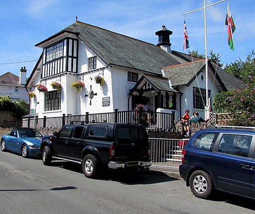
Dinas Powys Parish Hall. Viewed across Britway Road. Built in 1907 in the Arts and Crafts style. Grade II listed in 2002.
Dinas Powys Methodist Church. Viewed across Station Road in August 2016. The information board states that the church entrance is now from Mount Road. The church is part of the Vale of Glamorgan Methodist Circuit, a group of ten Methodist churches in the southern part of the old county of Glamorgan, between Cardiff and Bridgend.


