Duntulm Castle Walk
![]()
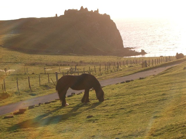
![]() Visit the fascinating ruins of this 14th century coastal castle and enjoy wonderful views of Tulm Bay on this walk in Trotternish.
Visit the fascinating ruins of this 14th century coastal castle and enjoy wonderful views of Tulm Bay on this walk in Trotternish.
There is a parking area just off the A855 with a footpath leading to the castle ruins. The castle is surrounded by dramatic cliffs with wonderful views over Tulm Bay and Duntulm Bay. The ruins and surrounding scenery are quite striking and very photogenic.
Duntulm Castle Ordnance Survey Map  - view and print off detailed OS map
Duntulm Castle Open Street Map  - view and print off detailed map
Duntulm Castle OS Map  - Mobile GPS OS Map with Location tracking
Duntulm Castle Open Street Map  - Mobile GPS Map with Location tracking
Explore the Area with Google Street View 
Further Information and Other Local Ideas
For a challenging climb on the island head to the Quiraing, the northernmost summit of the Trotternish. The hike is a favourite for many with some spectacular views to enjoy. The Old Man of Storr is another good option with some wonderful rock formations and views to enjoy.
Just to the south is Kilt Rock And Mealt Falls where there's a pretty loch, some wonderful rock formations and a coastal waterfall to see.
Head south east and you can visit the Island's capital at Portree. Here you can pick up the circular Portree Scorrybreac Walk and enjoy views of the picturesque harbour, the colourful buildings of Portree town and out to the Island of Raasay.
For more walking ideas in the area see the Isle of Skye Walks page.


