Forfar Loch Walk
![]()
![]() Follow the 2.5 mile trail around the beautiful Forfar Loch on this circular cycle or walk route in Angus. The loch is surrounded by woodland, grassland and some lovely countryside. Other attractions include pitch and putt, crazy golf and the Lochside Leisure Centre.
Follow the 2.5 mile trail around the beautiful Forfar Loch on this circular cycle or walk route in Angus. The loch is surrounded by woodland, grassland and some lovely countryside. Other attractions include pitch and putt, crazy golf and the Lochside Leisure Centre.
It's a great area for wildlife with kingfisher, otter, fox, roe deer and ospreys to look out for. There's also a Wildlife Garden with a variety of habitats to explore.
Postcode
DD8 1BT - Please note: Postcode may be approximate for some rural locationsForfar Loch Country Park Ordnance Survey Map  - view and print off detailed OS map
Forfar Loch Country Park Open Street Map  - view and print off detailed map
Forfar Loch Country Park OS Map  - Mobile GPS OS Map with Location tracking
Forfar Loch Country Park Open Street Map  - Mobile GPS Map with Location tracking
Dog Walking
The lochside path and the surrounding woodland are great for dog walking so you'll probably see other owners on a fine day.
Further Information and Other Local Ideas
Just to the east of the town you'll fine two more scenic lochs in the shape of Rescobie Loch and Balgavies Loch. The latter has some nice footpaths and is also a wildlife reserve. Here you'll find reedbeds and willow carr, attracting water rail, great crested grebe and a number of wintering wildfowl, including goldeneye, teal and wigeon. The reserve is also a haven for red squirrel and ospreys. The reserve has a car park and can be found at postcode DD8 2SE for your sat navs. Rescobie Loch sits just to its west and is a popular spot for anglers.
If you head south east towards Angus you'll find a couple of other fine country parks to explore. Crombie Country Park and Monikie Country Park are located close to each other and both are well worth a visit.
A few miles to the north west you could visit Kirriemuir and the Loch of Kinnordy. The RSPB nature reserve includes a wide variety of wildlife and nice waterside trails.
Cycle Routes and Walking Routes Nearby
Photos
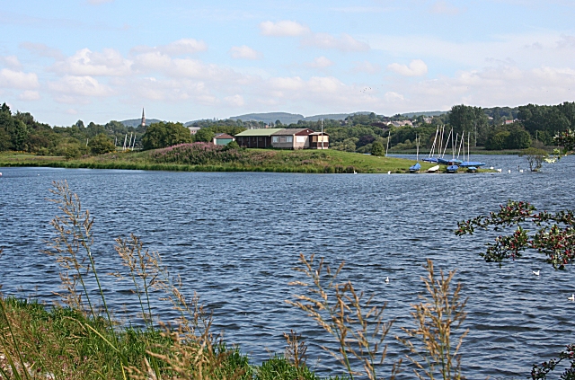
Forfar Loch. On the left is a sycamore which, though it has fallen, continues to flower. The sailing club premises on St Margaret's Inch are in the background.
Cottages by Forfar Loch. These cottages are on the north side of the loch beside the track leading to Garth, and they are seen here across the reed beds on the south side.
Forfar Loch Country Park. The footpath round the loch passes just beyond the benches and picnic tables at the head of the inlet to the north of St Margaret's Inch. The sheltered water and grassy beach are popular with swans, wintering geese and bathing dogs, but the water's edge can get pretty messy as a result, especially if the water level is low.
The farm is set back from the north side of the loch, but its location is less tranquil than it looks in this view from the south side of the loch because the A90 dual carriageway passes just a couple of hundred metres to the left of the farm.


