Guiting Power and Temple Guiting
![]()
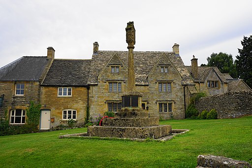
![]() This easy walk visits these two idyllic Cotswolds villages. It follows the North Cotswold Diamond Way through the countrsyide from Guiting Power to the nearby Temple Guiting. There's waterside paths along the Guiting Stream and a woodland section through Castlett Wood to enjoy. Both villages are also delightful. In Guiting Power there is a pretty village green and a Norman doorway to the church.
This easy walk visits these two idyllic Cotswolds villages. It follows the North Cotswold Diamond Way through the countrsyide from Guiting Power to the nearby Temple Guiting. There's waterside paths along the Guiting Stream and a woodland section through Castlett Wood to enjoy. Both villages are also delightful. In Guiting Power there is a pretty village green and a Norman doorway to the church.
If you would like to continue you walking in the area then you could follow the Warden's Way to the Slaughters and Bourton on the Water which are both close by.
Postcode
GL54 5TZ - Please note: Postcode may be approximate for some rural locationsGuiting Power and Temple Guiting Ordnance Survey Map  - view and print off detailed OS map
Guiting Power and Temple Guiting Open Street Map  - view and print off detailed map
Guiting Power and Temple Guiting OS Map  - Mobile GPS OS Map with Location tracking
Guiting Power and Temple Guiting Open Street Map  - Mobile GPS Map with Location tracking
Explore the Area with Google Street View 
Pubs/Cafes
The Farmers Arms - good home cooked food in this traditional Donnington brewery village pub. Postcode is GL54 5TZ.
Further Information and Other Local Ideas
The Donnington Way - Cotswolds Pub Walk passes through the village. The long circular walk visits 15 fine old Donnington Brewery pubs in the Cotswolds.
Cycle Routes and Walking Routes Nearby
Photos
Guiting Power church. Seen from the combined Diamond Way and Warden's Way long distance paths, St Michael's and All Angels is a wonderful example of a Norman church. The south door is a superb example of Norman style. The door is unusual in that it opens straight into the south transept of the church.


