Hambleden Lock Circular Walk

 This pretty Buckinghamshire village is nicely positioned for exploring the Chiltern Hills on foot. It's also a short walk from the River Thames where you can enjoy some nice easy waterside walking. This circular route takes you down to the river before visiting the village of Medmenham. On the way there's nice countryside views, riverside paths and some peaceful woodland sections too. The walk runs for just over 5 miles on fairly flat paths, with a moderate climb toward the end.
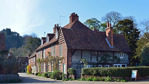
You start off at the public car park in the village. The village includes pretty cottages and a noteworthy church which dates from the 14th century. It includes a memorial to Cope D'Oyley (who died in 1633) and his family. The post office in the village serves also as the local shop and cafe, which is a good place for refreshments before or after your walk.
From the village you can pick up a footpath heading south to Mill End. Here you will find the picturesque Hambleden Mill and Hambleden Lock. The historic watermill was built in the late 18th century, possibly incorporating part of an earlier 17th century mill. It has now been converted into flats. The lock was built by the Thames Navigation Commission in 1773 and includes a very long weir. The great weir is impressive and there are walkways over it from the lock to the small village of Mill End on the Buckinghamshire bank.
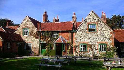
The route continues past Hambleden Place before picking up a riverside trail to take you east to Medmenham. The pretty village includes some old timber framed brick and flint cottages and some estate workers cottages built at the beginning of the 20th century from local chalk rock. The Dog and Badger Inn dates from late in the 16th century, and is a great place to stop for refreshments.
After passing through the village you return to Hambleden on footpaths heading north west through Killdown Bank and Binfield Woods. This final section includes a moderate climb to just over 300ft with some nice views from the high points.
To continue your walking in the area you could try our Turville Circular Walk which uses the Shakespeare's Way and Chiltern Way to visit the famous Chitty Chitty Bang Bang Windmill, Stonor Park and the Warburg Nature Reserve.
Hambleden Ordnance Survey Map  - view and print off detailed OS map
Hambleden Open Street Map  - view and print off detailed map
Hambleden OS Map  - Mobile GPS OS Map with Location tracking
Hambleden Open Street Map  - Mobile GPS Map with Location tracking
Cycle Routes and Walking Routes Nearby
Photos
Medmenham Abbey, the mansion built in 1595 on the site of a Cistercian abbey. To the right are the ruined folly tower and cloister that were added in 1755 for Sir Francis Dashwood.


