Hawnby Hill
![]()
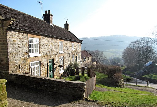
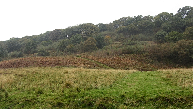
![]() This circular walk takes you up to the summit of Hawnby Hill from the village of Hawnby in Ryedale area of the North York Moors.
This circular walk takes you up to the summit of Hawnby Hill from the village of Hawnby in Ryedale area of the North York Moors.
The hill is located about a mile to the north of the settlement and can be reached by following a grassy footpath from close to the village centre. It will take you past Crooked Hill Wood to the limestone hill crag which stands at a height of 298 metres. From the top there are some excellent views over the surrounding moorland and hills. You can then descend back to the village on an alternative path via Hill End House.
The area is one of the less visited places in the national park so it should be quite a peaceful walk. The village itself is also very quiet with a few stone cottages and a 12th century church by the River Rye.
Postcode
YO62 5QS - Please note: Postcode may be approximate for some rural locationsHawnby Hill Ordnance Survey Map  - view and print off detailed OS map
Hawnby Hill Open Street Map  - view and print off detailed map
Hawnby Hill OS Map  - Mobile GPS OS Map with Location tracking
Hawnby Hill Open Street Map  - Mobile GPS Map with Location tracking
Walks near Hawnby
- Boltby Forest - This large area of coniferous woodland on the western edge of the North York Moors is very popular with mountain bikers and walkers
- Silton Forest - Enjoy miles of mountain bike trails and footpaths in this large coniferous forest on the North York Moors
- Sutton Bank and the Kilburn White Horse - This challenging circular walk in the North York Moors visits the Kilburn White Horse, the lovely Gormire Lake and the scar at Sutton Bank
- Cleveland Way - This wonderful trail runs from Helmsley to Filey, taking you through the beautiful North York Moors national park, atop the Hambleton Hills ridge and along the stunning North Yorkshire coastline.
The trail begins in Helmsley, with the first section taking you through the heather moorland of the North York Moors, passing the village of Osmotherley, the pretty Cod Beck Reservoir and the ancient stones at Lord Stones Country Park and the Wainstones.
After enjoying the fabulous views on the elevated moors you arrive at Saltburn to begin the coastal stretch - Hambleton Hills - This walk explores the Hambleton Hills range on the western edge of the North York Moors
- Helmsley to Rievaulx Abbey - This is a popular walk which takes you from the medieval Helmsley Castle to the fascinating ruins of Rievaulx Abbey
- Duncombe Park - Enjoy woodland trails, a spectacular landscaped garden and the National Centre for Birds of Prey in this large park and nature reserve in Helmsley, Yorkshire.
You can enjoy a gentle stroll around the 35 acre 18th century green gardens - Gormire Lake - A short and easy walk around this pretty lake in the North York Moors
- Hambleton Hills - This walk explores the Hambleton Hills range on the western edge of the North York Moors
- Silton Forest - Enjoy miles of mountain bike trails and footpaths in this large coniferous forest on the North York Moors
Pubs/Cafes
Back in the village you can enjoy some post walk rest and refreshment at The Owl. Inside the cosy bar has roaring fires, real ales and delicious food. Outside there's wood-fired pizza from the Sheperds Hut in the garden area. You can find the inn at postcode YO62 5QS for your sat navs. They also provide good quality accommodation if you need to stay over.
Dog Walking
The route is a good one for you to enjoy with your dog. The Owl mentioned above is also dog friendly.
Further Information and Other Local Ideas
A few miles to the west there's the expansive Boltby Forest to explore. There's miles of good walking and mountain bike trails to be found here.
Just to the south there's a major local highlight at the historic Rievaulx Abbey.
For more walking ideas in the area see the North York Moors Walks page.


