Henrhyd Falls
![]()
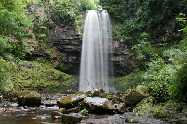
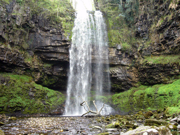
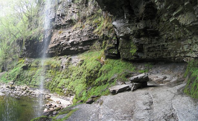
![]() Visit the spectacular Henrhyd Falls and the rushing Nant Llech River on this splendid walk in the Brecon Beacons National Park. The falls are the highest in South Wales at 90 feet (27m). There's the additional bonus of being able to walk around the back of the falls and see it from a completely different perspective.
Visit the spectacular Henrhyd Falls and the rushing Nant Llech River on this splendid walk in the Brecon Beacons National Park. The falls are the highest in South Wales at 90 feet (27m). There's the additional bonus of being able to walk around the back of the falls and see it from a completely different perspective.
The walk starts at the National Trust car park at Dol Henrhyd, Coelbren (postcode:SA10 9PH). From here you follow a footpath heading west to the falls and then along the Nant Llech River towards Ynyswen. On the way you will pass through a lovely wooded valley where you will see another small waterfall and a disused watermill before coming to the River Tawe. Return to the start point on the same path.
The final scene of the film The Dark Knight Rises was filmed at Henrhyd Falls, where it doubled as the entrance for the Batcave. This has drawn extra visitors to the site so it can be busy at peak times in the summer holidays.
Postcode
SA10 9PH - Please note: Postcode may be approximate for some rural locationsHenrhyd Falls Ordnance Survey Map  - view and print off detailed OS map
Henrhyd Falls Open Street Map  - view and print off detailed map
Henrhyd Falls OS Map  - Mobile GPS OS Map with Location tracking
Henrhyd Falls Open Street Map  - Mobile GPS Map with Location tracking
Pubs/Cafes
The delightful Coelbren Welfare Hall Tea Rooms are located a short distance from the falls and well worth a visit. They do delicious homemade food with lovely cakes and sweet treats as well. You can find the cafe just south west of the car park at 9 Station Rd, Coelbren, with a postcode of SA10 9P for your sat navs. There's a car park there or in the village nearby.
Dog Walking
Fit dogs should enjoy this walk, though there are some steep steps along the way. It can be a bit slippy and noisy behind the falls so you may want to skip that bit. The Coelbren tea rooms mentioned above are dog friendly.
Further Information and Other Local Ideas
Some of the paths on this walk can get a bit slippy and muddy so good footwear is advised.
Photos
This is a small tributary of the Afon Tawe that runs down to Swansea. This great waterfall is just after its run off from the Brecon Beacons area.
Sgwd Henrhyd in flood conditions in July 2009. After a full night of heavy rain the flow of the Nant Llech had increased significantly though it was evident that levels were lower when this shot was taken than they had been a few hours earlier. Photography closer to the falls than this was impossible due to the wind and spray. The water has picked up some peaty colouration during its flow over the moorland to the north.
View of the falls icing up in January 2009 All the rock faces sport icicles and the top of the falls is frosted up despite the flowing water. The plunge pool is completely iced over allowing careful access to the very unusual pile of "snow" at the base of the fall. It is actually grains of ice about the consistency of cous-cous.


