Highcliffe Castle and Coast
![]()
![]() Explore the grounds of this 19th century Gothic Revival house and enjoy a walk along the splendid Highcliffe coast and cliffs. The castle is surrounded by attractive wide lawns and beautiful formal gardens. There are also nice woodland trails along the cliff top and a zig-zag path down to the beach. There's great views from the high points along the south coast towards Christchurch Bay and the Isle of Wight.
Explore the grounds of this 19th century Gothic Revival house and enjoy a walk along the splendid Highcliffe coast and cliffs. The castle is surrounded by attractive wide lawns and beautiful formal gardens. There are also nice woodland trails along the cliff top and a zig-zag path down to the beach. There's great views from the high points along the south coast towards Christchurch Bay and the Isle of Wight.
The walk also visits the Steamer Point Nature Reserve just to the west of the castle. The reserve has some nice woodland trails and a variety of flora and fauna to look out for.
Just to the east of the castle you'll find Chewton Bunny Nature Reserve. The wooded Chine has a trail leading to a pretty waterfall.
To extend your walking in the area you can pick up the Bournemouth Coast Path. If you head west you'll come to Christchurch and the delightful Stanpit Marsh Nature Reserve. Also nearby is Hengistbury Head and Mudeford with its lovely beaches and fabulous coastal views.
Heading east along the coast path takes you to Barton-on-Sea and Milford on Sea where you can explore the wonderful Keyhaven Marshes.
Postcode
BH23 4LE - Please note: Postcode may be approximate for some rural locationsPlease click here for more information
Highcliffe Castle and Coast Ordnance Survey Map  - view and print off detailed OS map
Highcliffe Castle and Coast Open Street Map  - view and print off detailed map
Highcliffe Castle and Coast OS Map  - Mobile GPS OS Map with Location tracking
Highcliffe Castle and Coast Open Street Map  - Mobile GPS Map with Location tracking
Pubs/Cafes
There's a nice on site tea room where you can enjoy refreshments after your walk. You can sit outside with lovely views of the grounds if the weather is good.
Dog Walking
The woodland trails in the grounds and the nearby beach are ideal for a bracing dog walk. You're bound to bump into other owners on a fine day.
Further Information and Other Local Ideas
Head a short distance west and you can pick up the popular Christchurch Harbour Walk. Here you can visit the lovely beach at Mudeford and the wonderful Christchurch Priory.
Just to the north east is the market town of New Milton where there's a train station and some pleasant waterside trails around the Ballard Water Meadows. You're also very close to the Wilverley Plain area of the New Forest here.
For more walking ideas in the area see the Dorset Walks page.
Cycle Routes and Walking Routes Nearby
Photos
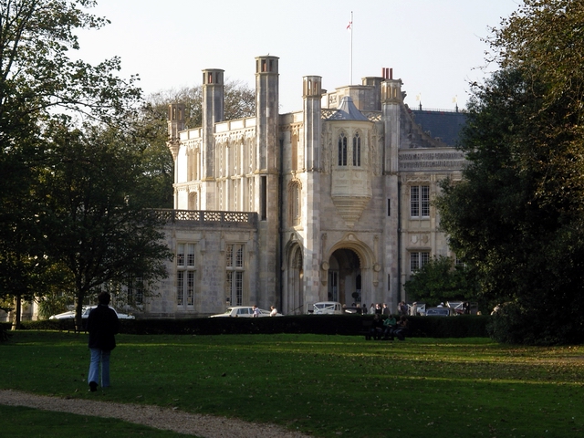
View of the castle and grounds. The castle is a Grade I listed building which was built between 1831 and 1835 by Lord Stuart de Rothesay. It has been described as "the most important remaining example of the Romantic and Picturesque style of architecture."
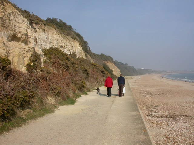
Friar's Cliff. Most of the cliffs between Friar's Cliff & Highcliffe have been invaded by scrub, or planted with trees to combat erosion. 250m remain, of Eocene Boscombe Sands & Barton Clay. Miner bees are much in evidence, flying in & out of holes in the sands in the cliffs. The cliffs are located just west of the castle.


