Holy Island Causeway Walk
![]()
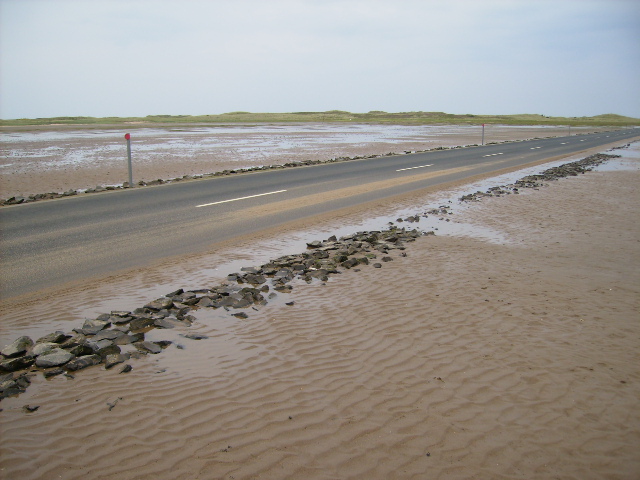
![]() Cross the wonderful causeway across Holy Island Sands on this walk in Northumberland. The Pilgrims Causeway runs for about 3 miles providing fabulous views to the island and surrounding coast. It's a special and unique walk following a solid path alongside the causeway road. It's essential to check the tide times tide times before you go as the island is cut off twice daily by fast incoming tides.
Cross the wonderful causeway across Holy Island Sands on this walk in Northumberland. The Pilgrims Causeway runs for about 3 miles providing fabulous views to the island and surrounding coast. It's a special and unique walk following a solid path alongside the causeway road. It's essential to check the tide times tide times before you go as the island is cut off twice daily by fast incoming tides.
Start the walk from the car park, located on Holy Island Road on the western side of the causeway. Here you can see a table of the tide times on an information board. You can then pick up the St Cuthbert's Way and head east over the causeway to Lindisfarne Castle and Holy Island. As you are making your way across you can see Snook Tower and Snook House on your left. The route then enters the island and finishes at Holy Island village.
On the island you can pick up a splendid coastal path taking you to the dramatic 16th century castle, the beautiful walled castle garden and the nearby lime kilns. The route also passes the ruins of the ancient Lindisfarne Priory. You can further extend your walk by heading west along the St Cuthbert's Way long distance trail and visiting St Cuthbert's Cave, which has strong connections with the island. The monks of Lindisfarne reputedly brought St. Cuthbert's body to the site in AD875 following Viking raids on the Island. They sheltered in the caves before travelling the old kingdom of Northumberland for a number of years before finally settling at Durham. The bones are now enshrined in Durham Cathedral behind the main altar. Near the cave there's also the peaceful woodland trails and steep rock climbing cliffs in the adjacent Kyloe Woods
Please click here for more information


