Horseshoe Pass Circular Walk

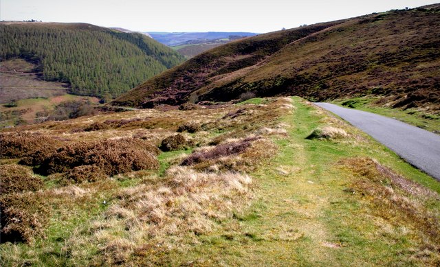
 This circular walk explores the amazing scenery around the Horseshoe Pass in Denbighshire, north-east Wales. The spectacular mountain pass rises to a height of 417 metres (1,368 ft) and is very popular with cyclists and walkers.
On this circular walk you will climb to Cyrn-y-Brain mountain, visit the expansive Llandegla Forest and pass through the scenic World's End Llangollen. It's a challenging hike with some fabulous views from the high points. Look out for wildlife including the Black Grouse as you make your way through the valley.
You can start the walk from the splendidly positioned Ponderosa Cafe. The large complex is located on the Horseshoe Pass A542 road and includes a good sized car parking area.
From here you can pick up trails heading east to Cyrn-y-Brain where there are a number of transmitter towers and moorland trails.
The walk continues east, skirting the edge of the Llandegla Forest where there are miles of peaceful cycling and walking trails. Here you can also pick up the Offa's Dyke Path and follow it south east towards World's End. It's something of a hidden gem with pretty streams, little waterfalls and attractive woodland to explore.
The route then passes Craig Arthur before heading west along the scenic Eglwyseg River towards Hen-Bandy. Here you turn north along a country lane which will lead you back to the cafe and the car park.
Postcode
LL20 8DR - Please note: Postcode may be approximate for some rural locationsHorseshoe Pass Ordnance Survey Map  - view and print off detailed OS map
Horseshoe Pass Open Street Map  - view and print off detailed map
Horseshoe Pass OS Map  - Mobile GPS OS Map with Location tracking
Horseshoe Pass Open Street Map  - Mobile GPS Map with Location tracking
Pubs/Cafes
The walk starts and finishes at the unique Ponderosa Cafe on the 'Horseshoe Pass' road. The large cafe serves a good range of meals and snacks. There's a splendid outdoor seating area with excellent views over the surrounding hills. At 1,400 ft above sea level you can see the Clwydian Mountain range and on a very clear day the three peaks of Snowdon. There's also Bed & Breakfast Accommodation, a gift shop and a large car park at the extensive complex.
Further Information and Other Local Ideas
You can extend the walk by continuing east to visit the amazing landscape and history at the Minera Lead Mines and Quarry.


