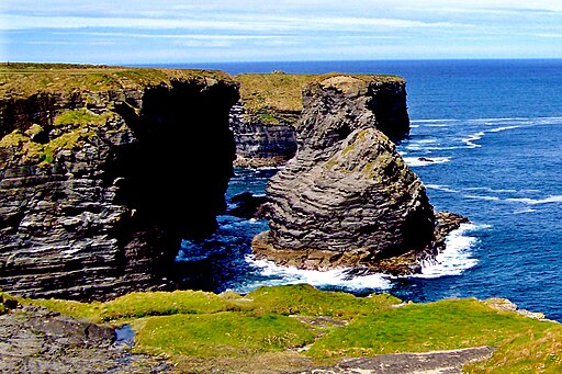
Kilkee Cliff Walk
![]() This walk follows a popular cliff top path in the town of Kilkee in County Clare.
This walk follows a popular cliff top path in the town of Kilkee in County Clare.
The walk runs for just over 6km along a good path with some small climbs along the way. There's wonderful coastal views, interesting rock formations and a variety of sea birds to look out for as you make your way along the path.
You can start the walk from the car parking area to the west of the town. From here you can pick up the trail and head west to Knockroe Point and Diamond Rocks.
The route then passes along Intrinsic Bay before finishing at Foohagh Point.
On the way you you can see the Aran Islands to the North, Kerry to the South and Loop Head to the West.
You can extend the walk by heading along the coast to explore Loop Head. Here you can visit the lighthouse and enjoy views of a giant sea stack and the mouth of the River Shannon.
Kilkee Cliff Walk Open Street Map  - view and print off detailed map
Ireland Walking Map - View All the Routes in the Country>>
Kilkee Cliff Walk Open Street Map  - Mobile GPS Map with Location tracking
Pubs/Cafes
At the start of the walk there's the Diamond Rocks Cafe for refreshments. The cafe serves good quality locally sourced food which you can enjoy with an amazing view from the outdoor seating area.
Further Information and Other Local Ideas
Head north along the coast and you will soon come to the delightful village of Spanish Point. Here you can try a walk along the fine local beach and enjoy some excellent views out to sea.


