Kilnwick Percy Walks

 This walk explores the hamlet of Kilnwick Percy near Pocklington in East Riding of Yorkshire.
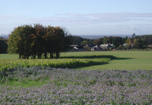
Here you can visit Kilnwick Percy Hall, a 19th century hall which has been the Madhyamaka Kadampa Meditation Centre for 30 years. Everyone can explore the grounds which include woodland walks, parkland and a lake. There's also nice views of the surrounding farmland from the footpaths.
At the site you can also enjoy a historical tour of the Grade II listed house and visit the World Peace Cafe, Gift Shop and Wolds Retreat bed and breakfast. There's free entry and an on site car park too.
Postcode
YO42 1UF - Please note: Postcode may be approximate for some rural locationsPlease click here for more information
Kilnwick Percy Ordnance Survey Map  - view and print off detailed OS map
Kilnwick Percy Open Street Map  - view and print off detailed map
Kilnwick Percy OS Map  - Mobile GPS OS Map with Location tracking
Kilnwick Percy Open Street Map  - Mobile GPS Map with Location tracking
Walks near Kilnwick Percy
- Pocklington Canal - Enjoy an easy waterside stroll along this lovely canal in East Riding of Yorkshire
- Wilberforce Way - Follow the Wilberforce Way from Hull to York on this walk created in memory of Hull's most famous son, William Wilberforce the Slave abolitionist
- Allerthorpe Woods - This area of common land near Pocklington has some nice tracks to follow through the attractive pine woodland
- Millington Woods - Visit these delightful woods in the Yorkshire Wolds on this short walk near Pocklington
- Bishop Wilton - This pretty little village in the East Riding of Yorkshire is a pleasant place to start a walk into the Yorkshire Wolds
- Stamford Bridge - This historic village is located in the East Riding of Yorkshire
- Minster Way - This splendid walk runs between the well known minsters at Beverley and York, visiting Arram, Scorborough, North Dalton, Lockington, Millington, Great Givendale, Bishop Wilton, Full Sutton, Stamford Bridge, Kexby and Fulford
Further Information and Other Local Ideas
Head west into Pocklington and you can pick up the Pocklington Canal Walk and enjoy an easy waterside stroll along the towpath.


