Llanymynech Hill and Rocks Walk
![]()
![]() This walk climbs to Llanymynech Hill and Asterley Rocks above the village of Llanymynech in Powys, Wales.
This walk climbs to Llanymynech Hill and Asterley Rocks above the village of Llanymynech in Powys, Wales.
The village is a lovely place for a stroll with easy trails along the Montgomery Canal and a more challenging climb to the lovely viewpoint to the north of the settlement. It sits in a significant position right on the England/Wales border.
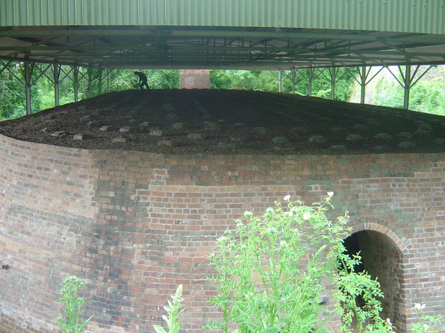
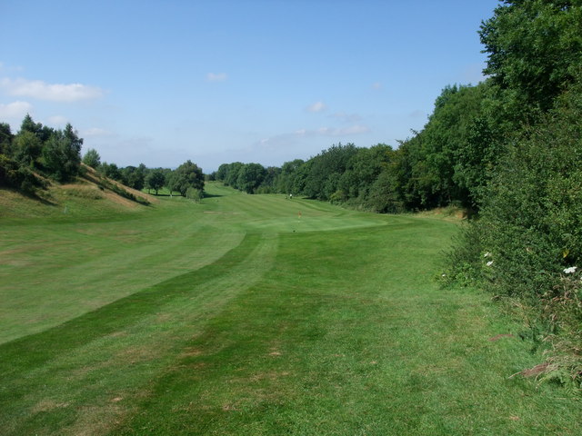
The walk starts in the village where you can pick up the Offa's Dyke Path and follow the waymarked footpath north to the the Heritage area which includes the Montgomery Canal visitor centre, the Hoffmann Lime Kiln and the old quarry. Soon after you will come to Asterley Rocks and Llanymynech Hill which stands at a height of 225 metres and includes an Iron Age hillfort and a Trig Point. There's splendid views here over the surrounding hills and countryside. You can then follow paths around the hill and the adjacent golf course before returning to the village.
Postcode
SY22 6EJ - Please note: Postcode may be approximate for some rural locationsLlanymynech Hill and Rocks Walk Ordnance Survey Map  - view and print off detailed OS map
Llanymynech Hill and Rocks Walk Open Street Map  - view and print off detailed map
Llanymynech Hill and Rocks Walk OS Map  - Mobile GPS OS Map with Location tracking
Llanymynech Hill and Rocks Walk Open Street Map  - Mobile GPS Map with Location tracking
Pubs/Cafes
Head to the Bradford Arms for some post walk refreshment in the village. The historic hotel is set in a former 17th century coaching inn and then Victorianised when it formed part of the Earl of Bradford’s estate in the early 1900’s. They serve good quality food and can be found at postcode SY22 6EJ for your sat navs.
Dog Walking
The hill is a nice place to take your dog for a walk and the Bradford Arms mentioned above is also dog friendly.
Further Information and Other Local Ideas
Head south and you'll find the village of Middletown where you can enjoy a climb to Rodney's Pillar on Breidden Hill near Welshpool. The monument was built in 1781–82 to commemorate the naval victories of Sir George Brydges Rodney, Admiral of the White during the American War of Independence. There are some nice woodland trails, an Iron Age Hillfort and fine views from the summit to enjoy here.
A few miles to the east there's Nesscliffe Hill Country Park. The attractive park includes more fine viewpoints and the mysterious Kynaston's Cave.
Cycle Routes and Walking Routes Nearby
Photos
Hoffmann Lime kiln. Top of Hoffmann lime kiln at Llanymynech heitage area. Firing of the kiln was done from the top as can be seen from the figure in the distance.
Old Quarry on Llanymynech Hill. Part of the old quarry workings on the hill, showing heavily excavated scarring on the sheer rock face, although nature is beginning to take a foothold. The Offa's Dyke National Trail passes close to this spot.
View towards Llanymynech Hill. The white house is just in Wales; the Wales/England border running exactly along the right-hand edge of the picture.


