Lych Way
![]()
![]() Follow in the footsteps of medieval church goers on this ancient path on Dartmoor Forest. The path was used by people travelling from their farms on the moor to the church in Lydford. It's also known as the 'Way of the Dead' as people would carry their dead to the graveyard for burials as well. The path runs for nearly 12 miles and climbs to a height of over 1500 feet so it is a challenging walk. You are rewarded with splendid views across Dartmoor for much of the way.
Follow in the footsteps of medieval church goers on this ancient path on Dartmoor Forest. The path was used by people travelling from their farms on the moor to the church in Lydford. It's also known as the 'Way of the Dead' as people would carry their dead to the graveyard for burials as well. The path runs for nearly 12 miles and climbs to a height of over 1500 feet so it is a challenging walk. You are rewarded with splendid views across Dartmoor for much of the way.
You can start the walk from the car park at Bellever and then head west across Bellever Forest. The path leaves the woods and then climbs to Longaford Tor passing the eery Wistman's Wood on the way.
You continue west, passing Beardown Tors and Cocks Hill before coming to Higher Willsworthy and Willsworthy Bridge.
The final section takes you past Willsworthy Camp into Lydford where you can explore the wonderful Lydford Gorge.
Lych Way Ordnance Survey Map  - view and print off detailed OS map
Lych Way Open Street Map  - view and print off detailed map
*New* - Walks and Cycle Routes Near Me Map - Waymarked Routes and Mountain Bike Trails>>
Lych Way OS Map  - Mobile GPS OS Map with Location tracking
Lych Way Open Street Map  - Mobile GPS Map with Location tracking
Cycle Routes and Walking Routes Nearby
Photos
During mediaeval times the village of Lydford on the north-western side of Dartmoor was one of the four most important settlements in Devon with its own Norman Fort, and Castle. Folk who lived and eked out a living in the centre of Dartmoor were therefore taken to Lydford for burial when they died, and the route across the moors from the Hexworthy area to Lydford was known as the Lych Way.
Snaking across very flat boggy moorland this is the bridleway looking back in the Hexworthy direction. Up until 1999 the bridleway followed a straight line route more or less due west from the Higher Cherrybrook Bridge car park, but it was diverted to its current course in that year.
The planted trees in the distance form part of the Bellever Forest.
Bridge on the Lych Way. There's been a lot of work done along this route to make it passable, but on this side of the bridge the ground is quite muddy. The actual course of the Gawler Brook is crossed further east along the bridleway.
Moorland by the B3212. This boggy area is on the watershed between the East and West Dart rivers. On the horizon are parts of Fernworthy Forest.
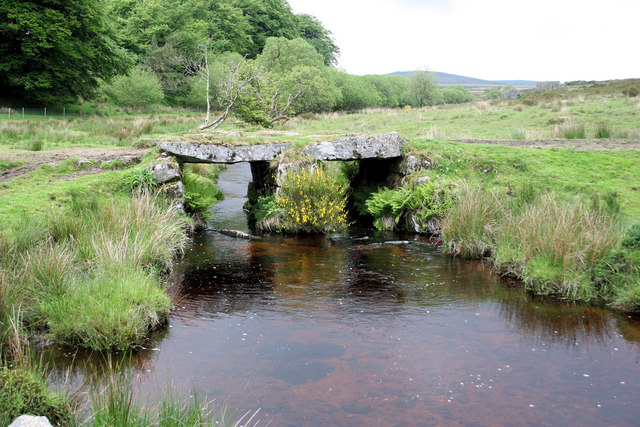
A clapper bridge over Cherry Brook within the area of the old Powder Mills. Used to be on the Lych Way until it was re-routed through the north part of the mills. The lych Way remains the only way to access the Powder Mills as the access past the Pottery is private.
Towards Higher White Tor Looking across the B3212 from Bellever woodland. The sign in the phot is for the Lych Way, the route that dead inhabitants of the moor were carried for burial at Lydford church, which is a huge parish covering most of the central part of the moor. The prominent tor is Higher White Tor.


