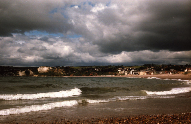
Lyme Regis to Seaton Undercliff Walk
![]()
![]() Travel from Dorset into Devon on this popular walk through the Undercliff National Nature Reserve. The reserve is one of the highlights on the Jurassic Coast with a wide variety of flora and fauna to look out for.
Travel from Dorset into Devon on this popular walk through the Undercliff National Nature Reserve. The reserve is one of the highlights on the Jurassic Coast with a wide variety of flora and fauna to look out for.
It's a 7 mile walk with some challenging climbs and wonderful clifftop coastal scenery. The stretch of coast is of high geological significance containing rocks from the Triassic, Jurassic and Cretaceous periods of geological time. It's also botanically diverse with species rich chalk grassland, holm oak, rhododendron, orchids and laurel.
Starting on the sea front in Lyme Regis you pick up the South West Coast Path and head west past the famous Cobb. The path then climbs to the Ware Cliffs via Chimney Rock. Ware Cliffs have nice lush green vegetation with a high point of 137 metres (449 ft) at Black Ven. The cliffs are thought to be around 199-189 million years old.
You continue west to the lovely Pinhay Bay where there are more tall cliffs and some rugged terrain. The next stage takes you past Whitlands Cliff to Charton Bay, before coming to the splendid Axe Estuary Nature Reserve at Axmouth. It's a great place for birdwatching with many different types of wildfowl and wading birds to look out for.
After crossing the Axe Estuary the walk finishes on the front at Seaton.
Lyme Regis to Seaton Undercliff Walk Ordnance Survey Map  - view and print off detailed OS map
Lyme Regis to Seaton Undercliff Walk Open Street Map  - view and print off detailed map
*New* - Walks and Cycle Routes Near Me Map - Waymarked Routes and Mountain Bike Trails>>
Lyme Regis to Seaton Undercliff Walk OS Map  - Mobile GPS OS Map with Location tracking
Lyme Regis to Seaton Undercliff Walk Open Street Map  - Mobile GPS Map with Location tracking
Pubs/Cafes
At the Seaton end you could enjoy some refreshments at The Vault Bar. The pub is located in a lovely spot right on the sea front. You can enjoy a meal outside with coastal views on sunny summer days. The pub is located at East Walk with a postcode of EX12 2LN for your sat navs.
At the other end of the route there's the Royal Standard in Lyme Regis. It's located right next to the famous Cobb with a harbour-deck area. You can sit outside here and enjoy the sea views. They do great seafood and also have live music during the holiday months. You can find it at 25 Marine Parade with a postcode of DT7 3JF.
Dog Walking
The area is great for dog walking with beaches and woodland areas for them to enjoy. The Royal Standard pub mentioned above is also very dog friendly.
Further Information and Other Local Ideas
You can extend your walking in Seaton by heading north along the Seaton Tramway Walk through the Seaton Marshes towards Colyford and Colyton. The marshes are just north of the town and include ditches and ponds that attract a large variety of wildfowl, waders and butterflies.
If you continue west along the South West Coast Path you will soon come to the villages of Beer and Branscombe. Here you can try the wonderful Branscombe to Beer Walk which takes you past the stunning Hooken Cliffs, Jurassic Coast UNESCO World Heritage Site.
Head a few miles inland and you could try the National Trust's Lamberts Castle to Coneys Castle Walk. The walk visits historic old hill forts where you can enjoy some stunning views over the countryside of the Marshwood Vale.
For more walking ideas in the area see the Dorset Walks and Devon Walks pages.
Cycle Routes and Walking Routes Nearby
Photos
Axe estuary. The land slopes down from Hawksdown Hill on the right; further back is Boshill Wood and the furthest hill is the site of Musbury Castle.
Whitlands Cliff. The vegetation is so dense that in places it almost completely covers the chalk cliff face behind the Undercliff.


