Merrivale Walk
![]()
![]() This walk visits the Merrivale Prehistoric Settlement on Dartmoor.
This walk visits the Merrivale Prehistoric Settlement on Dartmoor.
The area is a fine place for a walk with a fascinating Bronze Age settlement surrounded by some lovely Dartmoor scenery. The ancient area includes a complex of ritual sites, three stone rows, a stone circle, standing stones and a number of cairns.
There is a car park just east of the photogenic Merrivale Bridge where you can start your walk. Trails will then take you around the site with great views over Dartmoor to enjoy on the way.
You can extend the walk by climbing to Great Staple Tor and Roos Tor for some wonderful views over the area. The climb to Great Mis Tor also starts from the eastern Merrivale car park.
Postcode
PL20 6ST - Please note: Postcode may be approximate for some rural locationsPlease click here for more information
Merrivale Ordnance Survey Map  - view and print off detailed OS map
Merrivale Open Street Map  - view and print off detailed map
Merrivale OS Map  - Mobile GPS OS Map with Location tracking
Merrivale Open Street Map  - Mobile GPS Map with Location tracking
Photos
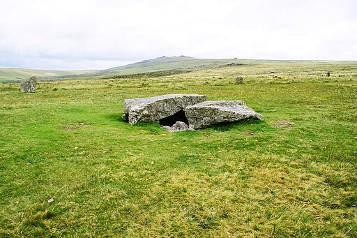
Merrivale Kistvaen. This is offset from the stone rows (south of them) but is in good condition despite the capstone having been cut for stone to use elsewhere. In the background are Great Mis & Little Mis Tors.
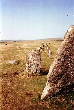
Stone row, Merrivale. It is quite possible that the ritual monuments of the Merrivale landscape belong to several different periods. In what way they might be related is a matter of conjecture, but such a vast array of monuments indicates that the site was of great spiritual importance to the people who lived in the area.
Merrivale Bridge. The River Walkham flows (to the left) under the older of the two bridges at Merrivale, carrying the old road across the moor. Taken from the modern A3357 embankment. A small island of enclosed fields follows the west bank of the Walkham for about a mile further upstream. The tors in the distance are Great Staple, and Roos.
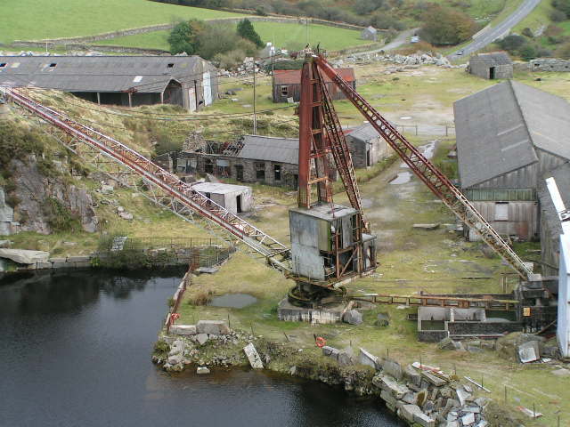
Rotting Crane, Merrivale Quarry. This former 35 ton Derrick Crane, built by Butters Cranes Ltd. of Glasgow in 1972, was used to shift the quarried stone. The quarry closed in December 1997 and much of the cutting machinery remained in the decaying sheds in this picture until contractors removed all the scrap metal, including the crane in late 2007. The deep flooded pit and huge spoil tip dominate the landscape here now.


