Walks Near Millom
![]()
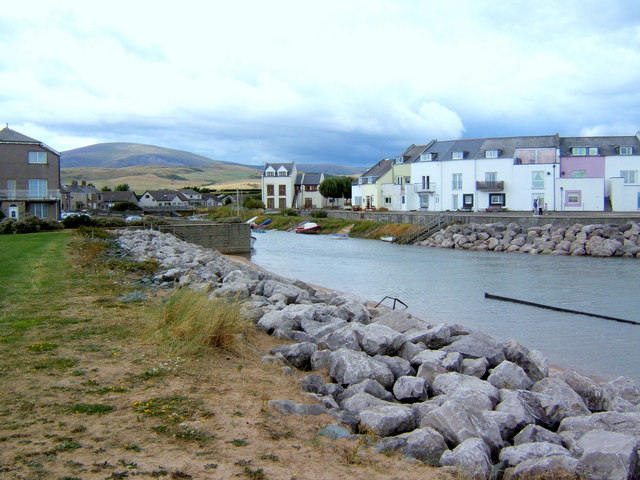
![]() This interesting coastal town is situated in a fine position on the edge of the Lake District National Park. The town has some lovely trails along the River Duddon Estuary and a beautiful local nature reserve with a large lake.
This interesting coastal town is situated in a fine position on the edge of the Lake District National Park. The town has some lovely trails along the River Duddon Estuary and a beautiful local nature reserve with a large lake.
This walk around Millom takes you along a section of the Cumbria Coastal Way to the Hodbarrow Lakes Nature Reserve and the neighbouring village of Haverigg.
The walk starts at the train station in the town centre. Head north east from here and you can pick up the coastal path and follow the waymarked trail along Borwick Rails Harbour to Duddon Villa and Crab Marsh. You turn south west to head towards the Hodbarrow Lighthouse and the large lagoon where there are great birdwatching opportunities. Follow the path round the lake and it will lead you to Haverigg where there's a cafe for refreshment.
The walk then heads back along the lake before turning north to return to the town.
Postcode
LA18 5AA - Please note: Postcode may be approximate for some rural locationsMillom Ordnance Survey Map  - view and print off detailed OS map
Millom Open Street Map  - view and print off detailed map
Millom OS Map  - Mobile GPS OS Map with Location tracking
Millom Open Street Map  - Mobile GPS Map with Location tracking
Walks near Millom
- Cumbria Coastal Way - Explore the wonderful coastline of Cumbria on this splendid long distance path
- Hodbarrow Lakes Nature Reserve - Enjoy a walk around Hodbarrow Lakes RSPB on the edge of the Lake District National Park
- Black Combe - Black Combe sits in the south west corner of the Lake District
- Muncaster Castle - Enjoy an easy stroll around the beautiful grounds and gardens of this Grade I listed building in Ravenglass
- Ravenglass to Eskdale - This walk from Ravenglass takes you to the beautiful Eskdale in the Lake District National Park
- Broughton in Furness - This small market town lies on the boundary of the Lake District National Park
- Swinside Stone Circle - This walk visits the Swinside Stone Circle north of Millom in Cumbria.
- Ravenglass - This coastal Cumbrian village is a great place for riverside, estuary and beach walking.
- Haverigg - This Cumbrian village lies in a scenic spot at the mouth of the Duddon Estuary.
Further Information and Other Local Ideas
The popular climb to Black Combe is located near the town. There's wonderful views to Wales, Ireland, Scotland and the Isle of Man from the summit of the hill.
If you head north along the coast path it will take you to Ravenglass where you can visit the historic Muncaster Castle. You can also try the Ravenglass Circular Beach Walk which visits the Drigg Beach Nature Reserve from the village. Here you'll find sand dunes, an abundance of interesting plantlife and lots of wildlife, with several species of wading birds to look out for on the river estuary.
A few miles to the north you'll find the mysterious Swinside Stone Circle. It's a beautiful, remote spot with the Lake District mountains making a fine backdrop to these photogenic ancient stones.
For more walking ideas in the area see the Lake District Walks page.
Photos
St George's Terrace, home of poet Norman Nicholson. The first building on the left displays a blue plaque in memory of the writer Norman Nicholson who lived there for most of his life. He is especially associated with the upstairs room. His poetry is noted for local concerns, straightforward language, and elements of common speech. Although known chiefly for poetry, Nicholson wrote much in other forms: novels, plays, essays, topography and criticism.
Looking across the Millom steelworks site towards Duddon Sands. Grass has almost completely covered over slag heaps in the foreground.


