Peak Forest Tramway Trail
![]()
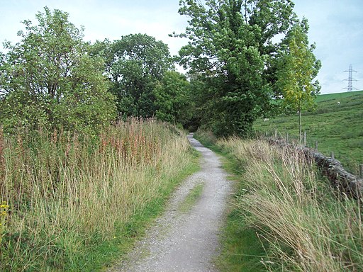
![]() This walk takes you along part of the route of the old Peak Forest Tramway which was used to carry limestone to the Peak Forest Canal in the 18th and 19th centuries. The western section of the line is now the route of the Peak Forest Tramway Trail which is open to walkers. The walk starts on Charly Lane near Bridgeholm Green and heads west through Whitehough to Buxworth. Here the trail links with the Peak Forest Canal at the attractive Bugsworth Basin. You can extend your walk by continuing along the towpath or heading up to Eccles Pike for nice views of the area.
This walk takes you along part of the route of the old Peak Forest Tramway which was used to carry limestone to the Peak Forest Canal in the 18th and 19th centuries. The western section of the line is now the route of the Peak Forest Tramway Trail which is open to walkers. The walk starts on Charly Lane near Bridgeholm Green and heads west through Whitehough to Buxworth. Here the trail links with the Peak Forest Canal at the attractive Bugsworth Basin. You can extend your walk by continuing along the towpath or heading up to Eccles Pike for nice views of the area.
Peak Forest Tramway Trail Ordnance Survey Map  - view and print off detailed OS map
Peak Forest Tramway Trail Open Street Map  - view and print off detailed map
Peak Forest Tramway Trail OS Map  - Mobile GPS OS Map with Location tracking
Peak Forest Tramway Trail Open Street Map  - Mobile GPS Map with Location tracking
Further Information and Other Local Ideas
The Peak Forest Tramway was an early horse and gravity-powered industrial railway system in Derbyshire. Opened for trade on 31 August 1796, it remained in operation until the 1920s. Much of the route and the structures associated with the line remain. Its purpose was to carry limestone from the vast quarries around Dove Holes down to Bugsworth Basin via Chapel-en-le-Frith and Chinley, where much of it was taken by boat along the Peak Forest Canal and the Ashton Canal to Manchester and beyond.
Cycle Routes and Walking Routes Nearby
Photos
Part of Bugsworth Basin, Buxworth. These are lines of stone slab sleepers which supported the L-shaped rails of the Peak Forest Tramway. The boys are fishing in the canal basin.
Boats entered and left the Bugsworth complex, via this entrance basin. The Wharfinger's (or Canal House) on the right was built in or about 1797 as a house and office for German Wheatcroft, the first Wharfinger (or Basin Manager) at Bugsworth. An adjacent building was built as a stable for his horse. A loaded barge was not allowed out through the Gauging Stop Place outside the office until it had been assessed or 'gauged'. This was necessary to measure the weight and hence the value of the boat's cargo. This in turn determined the tolls paid by the boat on the canal. The displacement of the boat was measured at four known points and an average reading taken. This reading together with details of the cargo, distance to be travelled and the gauge plate number was compared with special tables in the office. A permit was then issued and the boat could leave.


