Pontcysyllte Aqueduct Walk
![]()
![]() Visit the longest and highest aqueduct in Britain and enjoy waterside walking along the Llangollen Canal on this lovely walk in Denbighshire.
Visit the longest and highest aqueduct in Britain and enjoy waterside walking along the Llangollen Canal on this lovely walk in Denbighshire.
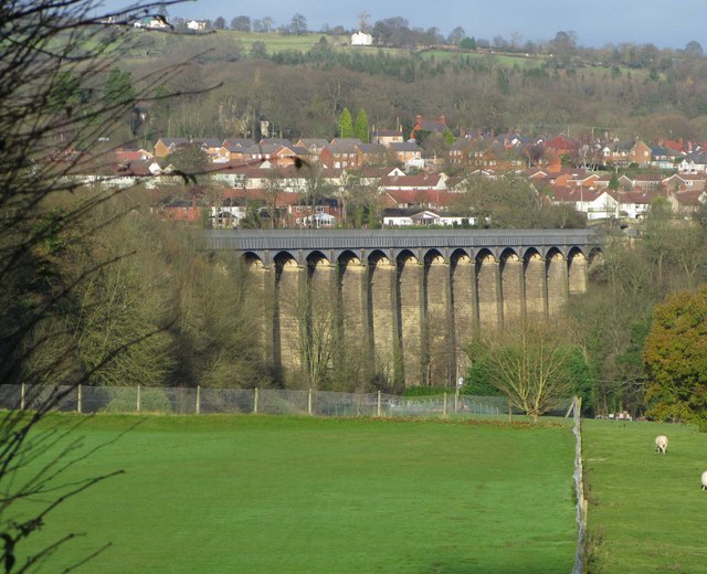
The site includes a good sized car park from which you can start the walk. There is also a handy information point with details about the history of the impressive structure. The 18-arched stone and cast iron structure is used by narrowboats and was completed in 1805 having taken ten years to design and build. It's now a Grade I listed building and a UNESCO World Heritage Site.
From the car park you can follow footpaths south up to the aqueduct which carries the Llangollen Canal over the River Dee. From this elevated position there are wonderful views over the stunning countryside of the Vale of Llangollen and the Dee Valley.
The route crosses the structure before heading along the canal and returning along a roadside section of the Offa's Dyke Path.
This eventually bends round to the canal where a final waterside section leads you back to the car park.
For a longer route you could try the Chirk to Llangollen Canal Walk which starts just to the south of the structure at Chirk.
The car park is also the start point for the Panorama Walk which will take you up to the lovely World's End. The attractive gorge is a great place for a walk with pretty streams, little waterfalls and attractive woodland. You could also continue along the canal to the town of Llangollen which is located just a few miles to the west.
Postcode
LL20 7TU - Please note: Postcode may be approximate for some rural locationsPontcysyllte Aqueduct Ordnance Survey Map  - view and print off detailed OS map
Pontcysyllte Aqueduct Open Street Map  - view and print off detailed map
Pontcysyllte Aqueduct OS Map  - Mobile GPS OS Map with Location tracking
Pontcysyllte Aqueduct Open Street Map  - Mobile GPS Map with Location tracking
Pubs/Cafes
A new floating café has opened at Trevor Basin near to the car park. They do a good range of meals and snacks in a delightful location. Just to the north you'll find The Telford Inn where you can enjoy a pub meal. It's located next to the canal at postcode LL20 7TT for your sat navs.
Just to the south there's The Aqueduct Inn. They have a balcony here where you can enjoy fine views of the canal and the aqueduct. You can find the pub at Holyhead road, Froncysyllte with a postcode of LL20 7PY.
Dog Walking
It's a nice place to explore with your dog. The Telford Inn and Aqueduct Inn mentioned above are also dog friendly.
Further Information and Other Local Ideas
Just to the south of Chirk you can visit the Chirk Aqueduct and the adjacent viaduct. You can access the site by heading through the Chirk Tunnel just to the west of the train station. There are some glorious views over the River Ceiriog Valley from the top of the elevated structure. Crossing the aqueduct will take you across the border into England.
The circular Trevor to Llangollen Canal Walk starts from the car park. You can follow the canal to nearby Llangollen before returning to Trevor via the Panorama Walk and the Offa's Dyke Path. The route also passes the medieval Castell Dinas Bran where you can enjoy historic ruins and wonderful views over the area.<
Cycle Routes and Walking Routes Nearby
Photos
Looking over the unguarded western edge of the Pontcysyllte Aqueduct to the Dee and Cysylltau bridge


