Reculver Country Park
![]()
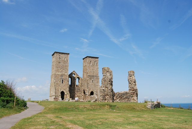
![]() This country park is located on the Kent coast at Reculver. The cliff top views over Herne Bay are fantastic with a wide variety of wildlife and plantlife to see. The Reculver Towers are also located in the park. They are an important local landmark and are listed as a Scheduled Ancient Monument.
This country park is located on the Kent coast at Reculver. The cliff top views over Herne Bay are fantastic with a wide variety of wildlife and plantlife to see. The Reculver Towers are also located in the park. They are an important local landmark and are listed as a Scheduled Ancient Monument.
The park also includes the Bishopstones Nature Reserve where you can look out for wildlife including Sand martins, skylarks, meadow pipits and corn buntings.
The route below is designed for walkers as it takes you along footpaths around the park but there is a cycle route running right through the park.
The park is located just a few miles from Herne Bay so you could visit the park by following the coast path on our Herne Bay to Reculver Walk or head to the delightful coastal town of Whitstable on our Whitstable to Herne Bay Walk.
Postcode
CT6 6SU - Please note: Postcode may be approximate for some rural locationsPlease click here for more information
Reculver Country Park Ordnance Survey Map  - view and print off detailed OS map
Reculver Country Park Open Street Map  - view and print off detailed map
Reculver Country Park OS Map  - Mobile GPS OS Map with Location tracking
Reculver Country Park Open Street Map  - Mobile GPS Map with Location tracking
Pubs/Cafes
There's a nice on site cafe selling drinks and snacks. You could also visit The King Ethelbert Inn which is right next to the park.
Dog Walking
The park is very popular with dog walkers so you'll probably see other owners on your visit. The King Ethelbert mentioned above is also dog friendly.
Cycle Routes and Walking Routes Nearby
Photos
Roman Wall, Reculver Roman Fort. This is all that remains of Regvlbivm. The fort once stood on a headland overlooking the Wantsum channel, separating Kent from the Isle of Thanet. The channel as long since silted up & filled in.


