Rhinog Fawr Walk
![]()
![]() Visit the Rhinogs range of mountains in the Snowdonia National Park and climb Rhinog Fawr on this challenging walk. You'll pass heathery slopes, little streams, rocky outcrops and two small lakes on your way to the top.
Visit the Rhinogs range of mountains in the Snowdonia National Park and climb Rhinog Fawr on this challenging walk. You'll pass heathery slopes, little streams, rocky outcrops and two small lakes on your way to the top.
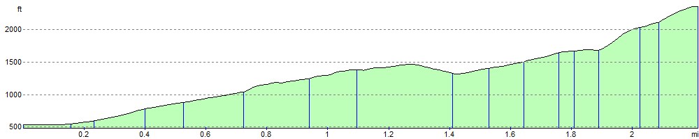
The walk begins from the Llyn Cwm Bychan car park a couple of miles north of Rhinog Fawr. You then follow the footpaths through a woodland area before climbing the Roman Steps. You'll pass the two pretty lakes of Llyn Morwynion and Llyn Du before coming to the 720 m (2,360 ft) summit of Rhinog Fawr. From here there are fabulous views over the surrounding peaks and lakes. The area is also a National Nature Reserve so look out for interesting flora and fauna including purple heather and wild goats.
Postcode
LL45 2PH - Please note: Postcode may be approximate for some rural locationsRhinog Fawr Ordnance Survey Map  - view and print off detailed OS map
Rhinog Fawr Open Street Map  - view and print off detailed map
Rhinog Fawr OS Map  - Mobile GPS OS Map with Location tracking
Rhinog Fawr Open Street Map  - Mobile GPS Map with Location tracking
Explore the Area with Google Street View 
Further Information and Other Local Ideas
Head to the coast and you could pick up the Harlech Walk. This visits the village of Llanbedr, the River Artro Estuary and the Morfa Dyffryn Nature Reserve. The beautiful reserve includes huge sand dunes, seashore, saltmarsh and grassland with a wide variety of wildlife to look out for. Near Llanbedr village there's also something of a hidden gem at the wonderful Nantcol Waterfalls. The area includes pleasant trails along the River Cwmnantcol with a series of rushing waterfalls to see along the way. There's also a circular walk around a small reservoir, just west of the falls.
Just to the south of Llanbedr there's the village of Dyffryn Ardudwy where there's a train station for public transport access. There's also the fascinating Dyffryn Ardudwy Burial chamber to explore in the village. The ancient site includes a hut circle and a number of dolmen dating back over 6000 thousand years.
For more walking ideas in the area see the Snowdonia Walks page.
Cycle Routes and Walking Routes Nearby
Photos

Situated on the Artro. This lake is situated at the base of the Roman Steps.

Llyn Morwynion

Summit of Rhinog Fawr. View of the summit, with Rhinog Fach in view on the far left and Y Llethr left of centre.

The smooth grassy ridge of Moelyblithcwm is a strong contrast to the wonderful rockiness of Rhinog Fawr across the valley.

Heathery moorland. Compared with the rocky appearance of y Llethr on the right, the terrain of Rhinog Fawr looks benign. In fact, the walk across Rhinog Fach and y Llethr is strenuous but easy to follow as clear paths can be followed along the ridge. The heathery coating of mountain makes progress a lot slower once the path is lost, which is almost unavoidable in places.

Not visible from here, a narrow path snakes its way through the heather and rocks from right to left in this view on the way to Llyn Du and Rhinog Fawr.

On the ascent of Rhinog Fawr. Llyn Du is visible from a clear path that at this point runs alongside a dry stone wall among the rocks, heather and bilberry plants. In terrain such as this it is inadvisable to stray from the few paths that exist. But a clear one leads from here to the summit of Rhinog Fawr.

Rhinog Fawr and Fach from Moelfre. Relaxing on the eastern slope of Moelfre after a long and wet day in the Rhinogydd. This square is west of the mountains and mostly rough open grassland, with a little bog in the south and opened-up enclosure in the north.
Elevation Profile