Ring of Brodgar and Brodgar RSPB Reserve - Stromness - Orkney Walk
![]()
![]() This walk visits a section of the fascinating Heart of Neolithic Orkney World heritage Site on Mainland island. The settlements are in a beautiful spot, next to the Loch of Stenness and surrounded by heather and wildlfowers. The area is also a RSPB Reserve with lots of wildlife to see. Look out for Curlews, drumming snipe, lapwings, dunlins, redshanks and oystercatchers as you make your way around the site.
This walk visits a section of the fascinating Heart of Neolithic Orkney World heritage Site on Mainland island. The settlements are in a beautiful spot, next to the Loch of Stenness and surrounded by heather and wildlfowers. The area is also a RSPB Reserve with lots of wildlife to see. Look out for Curlews, drumming snipe, lapwings, dunlins, redshanks and oystercatchers as you make your way around the site.
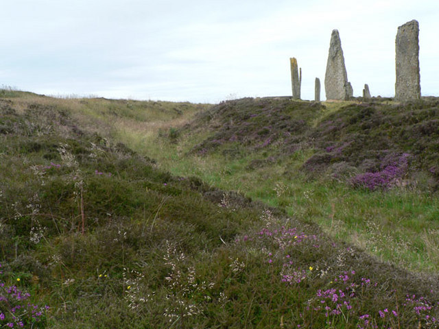
The notable ring of stones stands on a small isthmus between the Lochs of Stenness and Harray. They are the northernmost circle henge in Britain and the third largest. It is thought to have been erected between 2500 BC and 2000 BC.
After exploring the site you can head south east for just over half a mile and visit the Standing Stones of Stenness. The stones may be the oldest henge site in the British Isles. Based on radiocarbon dating, it is thought that work on the site had begun by 3100 BC.
Just next to the stones you will find Maeshowe. The Neolithic chambered cairn and passage grave dates from around 2800 BC. It's an impressive sight and one of the largest tombs in Orkney. The mound encasing the tomb is 115 feet (35 m) in diameter and rises to a height of 24 feet (7.3 m).
You can extend your walk by heading to Skara Brae and the Bay of Skaill.
You can virtually explore the area on the google street view link below!


