Silloth Walks - Near and Around
![]()
![]() This Cumbrian port town is located in a lovely spot on the Solway Firth, close to the Lake District hills. It's a fine place for a stroll with an attractive village green and a lovely promenade by the scenic harbour.
This Cumbrian port town is located in a lovely spot on the Solway Firth, close to the Lake District hills. It's a fine place for a stroll with an attractive village green and a lovely promenade by the scenic harbour.
This coastal circular walk visits Gurne Point and Skinburness to the north of the town. The route makes use of the Allerdale Ramble and the Cumbria Coastal Way which run through the area.
The route starts from the public car park on the sea front in Silloth. From here you can pick up the waymarked trail and follow it north along the beach to the Cote Lighthouse and Skinburness before coming to Gurne Point.
You then head around the Point before picking up a trail along Skinburness Creek. This will take you back to the coast path before following an inland trail through Silloth town centre towards the docks. From here it is a short stroll back to the beach and the car park.
The Solway Coast Walk starts in the town and runs to Bowness-on-Solway providing an opportunity for extending your walking from the town.
Silloth Ordnance Survey Map  - view and print off detailed OS map
Silloth Open Street Map  - view and print off detailed map
Silloth OS Map  - Mobile GPS OS Map with Location tracking
Silloth Open Street Map  - Mobile GPS Map with Location tracking
Pubs/Cafes
Back in the town The Albion is a good choice for some post walk refreshment. The friendly pub has a characterful interior with pictures of old Silloth decorating the walls along with two models of whaling trawlers. They also have a garden area for warmer days. You can find them on Eden Street at postcode CA7 4AS for your sat navs. There's also the Golf Hotel on Criffel Street which overlooks the famous green.
Dog Walking
The coastal paths make for a fine dog walk and the Albion mentioned above is also dog friendly.
Further Information and Other Local Ideas
Head south along the coast path and you could visit Allonby Bay and Maryport where you can pick up the popular Maryport to Allonby Walk.
The town is home to the Solway Coast Discovery Centre where you'll find a permanent exhibition about the Solway Coast Area of National Beauty. There's a wealth of information to be found here. The centre is located in the town centre at postcode CA7 4DD.
For more walking ideas in the area see the Cumbria Walks page.
Cycle Routes and Walking Routes Nearby
Photos
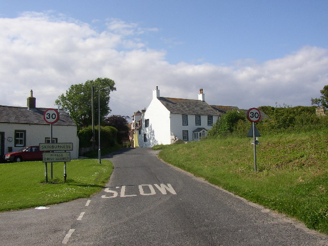
Skinburness. Skinburness was an important town with a market from the 11C to the 13C, was swept into the sea in 1301. It now has a popular hotel and many holiday cottages.
Grune Point. The triangular structure is a trig point built on top of an old pill-box. The pill box appears originally to have been constructed of sandbags which have long since rotted away, leaving only the inner, concrete structure. The flatness of the surrounds is emphasised by the height of the trig point - 7 metres.


