Sirhowy Valley Ridgeway Walk
![]()
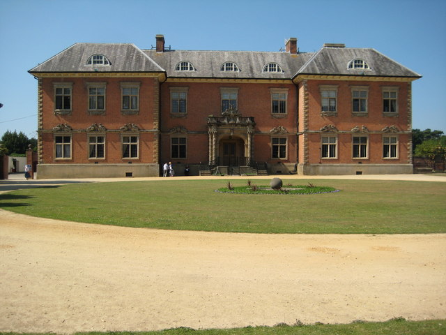
![]() This walk runs through the beautiful Sirhowy Valley in south Wales. The trail starts at the delightful Tredegar House Country Park near Newport. Here you will find a 17th-century mansion surrounded by 90 acres of beautiful gardens and parkland. The trail then heads north towards Risca and Blackwood before finishing at Tredegar.
This walk runs through the beautiful Sirhowy Valley in south Wales. The trail starts at the delightful Tredegar House Country Park near Newport. Here you will find a 17th-century mansion surrounded by 90 acres of beautiful gardens and parkland. The trail then heads north towards Risca and Blackwood before finishing at Tredegar.
Highlights on the walk include waterside sections along the Monmouthshire and Brecon Canal near Newport and along the Sirhowy river through Blackwood. You also visit the pretty Sirhowy Valley Country Park at Risca.
Here you can enjoy climb to Machen Mountain where there are spectacular views of the Rhymney Valley and Sirhowy Valley, Cardiff and the Bristol Channel.
The walk is waymarked with yellow arrow on a white disc.
Sirhowy Valley Ridgeway Walk Ordnance Survey Map  - view and print off detailed OS map
Sirhowy Valley Ridgeway Walk Open Street Map  - view and print off detailed map
*New* - Walks and Cycle Routes Near Me Map - Waymarked Routes and Mountain Bike Trails>>
Sirhowy Valley Ridgeway Walk OS Map  - Mobile GPS OS Map with Location tracking
Sirhowy Valley Ridgeway Walk Open Street Map  - Mobile GPS Map with Location tracking
Cycle Routes and Walking Routes Nearby
Photos
View over the Sirhowy valley. From the Rhymney Valley Ridgeway footpath, looking north-east over the farmland on these gentler upper slopes.
View northwest from Ridgeway. On the right is Ynysyfro Reservoir. The highest point on the horizon is Twmbarlwm Hill Fort. The footpath on the left is part of the Sirhowy Valley Walk as it descends from Ridgeway down to the Monmouthshire and Brecon Canal.
Elevation Profile


