St Briavels Walks
![]()
![]() This Gloucestershire based village sits close to the Welsh Border in the Forest of Dean and the River Wye Valley.
This Gloucestershire based village sits close to the Welsh Border in the Forest of Dean and the River Wye Valley.
This walk from the village passes the historic castle before heading west to the River Wye for some waterside walking.
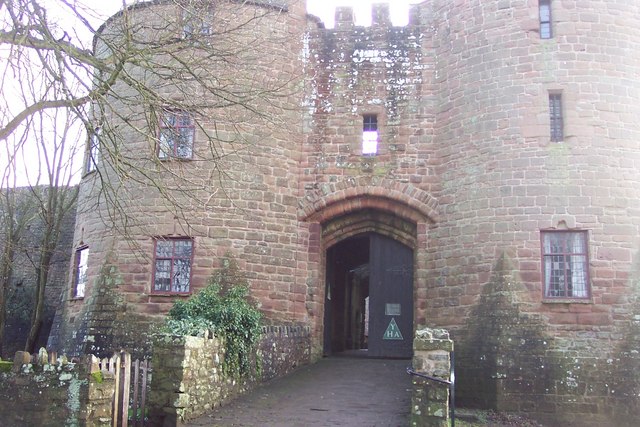
The walk starts at the castle in the village. The castle dates back to the 12th century and was a significant royal castle near the border with Wales. It was previously used as a royal administrative centre for the Forest of Dean. Today it is as a youth hostel but is also open to the public under the care of English Heritage.
The route then follows footpaths west to meet with the river at Bigsweir Bridge. The noteworthy bridge was built in 1827 and crosses the river Wye between St. Briavels in Enlgand to Llandogo in Wales.
At the bridge you can pick up the Wye Valley Walk and follow the waymarked trail south to Brockweir. The walk can be extended here by visiting Tintern Abbey to the south. The ruined abbey is one of the major highlights of the area and well worth a visit.
This route picks up the Offa's Dyke Path and follows it north across St Briavels Common before returning to the village.
Postcode
GL15 6TA - Please note: Postcode may be approximate for some rural locationsSt Briavels Ordnance Survey Map  - view and print off detailed OS map
St Briavels Open Street Map  - view and print off detailed map
St Briavels OS Map  - Mobile GPS OS Map with Location tracking
St Briavels Open Street Map  - Mobile GPS Map with Location tracking
Walks near St Briavels
- Tintern Abbey - Visit the fascinating ruins of this 12th century monastery and then explore the surrounding area on this walk on the England-Wales border
- Tintern Old Station - This park is situated in the Wye Valley Area of Outstanding Natural Beauty (AONB) near Chepstow
- Devil's Pulpit - Climb to this wonderful viewpoint and enjoy views over the Wye Valley AONB on this circular walk in Tintern in the Forest of Dean.
You can start the walk from the car park off the B4228 just north of Tidenham - Wye Valley Walk - This walk takes you through the beautiful Wye Valley in Gloucestershire, Herefordshire and Wales.
The walk begins on the mouth of the River Wye at Chepstow Castle in Monmouthshire and follows the River Wye north to Monmouth, passing the fascinating ruins of Tintern Abbey on the way - Wintour's Leap - Climb to this magnificent limestone viewpoint on this walk in the Wye Valley
- The Kymin - Climb to the 245m (800ft) summit of Kymin Hill and enjoy wonderful views down the Wye Valley, up into the Brecon Beacons and across to the Malvern Hills
- Symonds Yat Rock - Enjoy wonderful views over the Wye Valley from this well known viewpoint on the Herefordshire and Gloucestershire border
- Monmouth - A lovely circular walk around the Welsh town of Monmouth, visting Monmouth Castle, The Kymin viewpoint and the River Wye
- Brockweir - This Gloucestershire based village sits in a beautiful spot in the Forest of Dean
- Llandogo - This Monmouthshire village sits in a fine location in the lovely Wye Valley AONB.
- Chepstow Park Wood - This large area of woodland is located a few miles north west of Chepstow
- Wye Valley Greenway - This cycling and walking route runs along a disused railway line through the beautiful Wye Valley.
- Lancaut Walk - This walk explores the Lancaut Peninsula in the Wye Valley AONB
Further Information and Other Local Ideas
For more walking ideas in the area see the Forest of Dean Walks page.


