Staithes to Port Mulgrave Circular Walk

 This circular walk takes you from the pretty village of Staithes to the nearby Port Mulgrave. The route includes a coastal section before returning inland via coutryside and woodland. It's a 4 mile walk with some moderate climbs on the way.
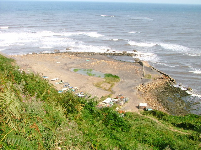
The walk starts at the picturesque Staithes Harbour where you can pick up the Cleveland Way National Trail. Follow the waymarked footpath south east along the cliff top and it will take you into Port Mulgrave. It used to be a busy port but when the mines closed, the harbour lost its commercial life. There are still a few cliff top houses overlooking a small harbour though.
The route then leaves the coast and heads south west past Hinderwell on country lanes and footpaths. These will take you to Oakrigg Wood where you turn north to return to Staithes.
Staithes to Port Mulgrave Circular Walk Ordnance Survey Map  - view and print off detailed OS map
Staithes to Port Mulgrave Circular Walk Open Street Map  - view and print off detailed map
Staithes to Port Mulgrave Circular Walk OS Map  - Mobile GPS OS Map with Location tracking
Staithes to Port Mulgrave Circular Walk Open Street Map  - Mobile GPS Map with Location tracking
Pubs/Cafes
In Staithes head to the excellent Cod and Lobster for some refreshments after your walk. The pub is in a great location right next to the harbour where you can sit outside and enjoy sea views with your fish and chips. Indoors there's old photos displaying the history of the area including the violent storms that have visited this little village. You can easily find it on the High Street at a postcode of TS13 5DF for you sat navs.
Further Information and Other Local Ideas
To continue your walking in the area try the Staithes to Runswick Bay Walk which visits a picture postcard fishing village. Or you could head in the other direction on the Saltburn to Staithes Walk.


