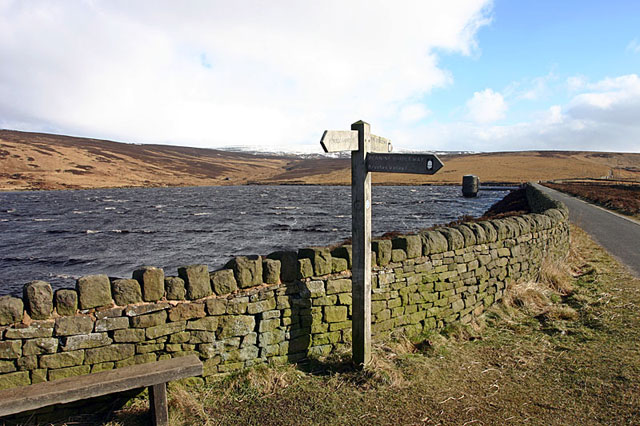
Swineshaw Reservoir
![]()
![]() Enjoy a circular walk around the Swineshaw Reservoirs on this route on the Pennine Moors.
Enjoy a circular walk around the Swineshaw Reservoirs on this route on the Pennine Moors.
Start the walk from the car park at Walkerwood Reservoir on Brushes Road. You can then follow the Pennine Bridleway east past Brushes Reservoir to the Higher and Lower Swineshaw Reservoirs. The route then follows footpaths around the Lower Reservoir before climbing to Hollingworthall Moor. Other paths then descend back to Walkerwood and the car park.
The reservoirs are located within the Stalybridge Country Park where there are more footpaths to try.
Postcode
SK15 3QP - Please note: Postcode may be approximate for some rural locationsSwineshaw Reservoir Ordnance Survey Map  - view and print off detailed OS map
Swineshaw Reservoir Open Street Map  - view and print off detailed map
Swineshaw Reservoir OS Map  - Mobile GPS OS Map with Location tracking
Swineshaw Reservoir Open Street Map  - Mobile GPS Map with Location tracking
Pubs/Cafes
The Hare & Hounds pub is located a short distance from the site in Millbrook. They do good food and have a small garden area too. You can find it a short stroll north west from the car park at 394 Huddersfield Rd with a postcode of SK15 3ET for your sat navs.
Further Information and Other Local Ideas
The long distance Tameside Trail passes the reservoir. The 30 mile circular walk explores several of the highlights of the River Tame Valley.
The circular walk to Alphin Pike passes to the north of the reservoir. If you follow the trail north west it will take you up to the hill top where there are some fine views over the area. You will also pass Wimbury Rocks and Indian Head where there are some photogenic rock formations.
Cycle Routes and Walking Routes Nearby
Photos
Pennine Bridleway, Higher Swineshaw Reservoir. Heading east along the dam wall of the reservoir. Higher Swineshaw Reservoir is the highest of four reservoirs in the Swineshaw Brook valley at about 300 metres above sea level.


