The Downs Bristol
![]()
![]() This walk explores Clifton Down and Durdham Down next to the Avon Gorge in Bristol. The Bristol Downs are a popular place for walkers and runners with nice footpaths, woodland trails and panoramic views of the Avon Gorge and the Clifton Suspension Bridge. It's a great area for birdwatching with 65 species to look out for. Keep your eyes peeled for jays, great tits, song thrush and bullfinch.
This walk explores Clifton Down and Durdham Down next to the Avon Gorge in Bristol. The Bristol Downs are a popular place for walkers and runners with nice footpaths, woodland trails and panoramic views of the Avon Gorge and the Clifton Suspension Bridge. It's a great area for birdwatching with 65 species to look out for. Keep your eyes peeled for jays, great tits, song thrush and bullfinch.
In the summer months the meadows and grassland are covered in pretty wildflowers which attract butterflies including small skipper, comma, orange-tip and
gatekeeper. There's also a nice tree trail with hornbeam, lime, monkey puzzle and sycamore trees. The trees are numbered with discs so you can easily identify them.
The downs are on the opposite side of the river to Leigh Woods where you will find miles of cycling and walking trails through the attractive woodland.
The Bristol Triangular City Walk passes over the downs, so you could pick this up to extend your walk.
The River Avon Trail also passes the downs. Pick up this long distance trail to explore the course of the river.
The Downs Bristol Ordnance Survey Map  - view and print off detailed OS map
The Downs Bristol Open Street Map  - view and print off detailed map
The Downs Bristol OS Map  - Mobile GPS OS Map with Location tracking
The Downs Bristol Open Street Map  - Mobile GPS Map with Location tracking
Pubs/Cafes
After your walk we recommend heading south from the Downs towards the Clifton Suspenion Bridge where you will find the fascinating Clifton Observatory. Here you can enjoy refreshments in the 360 cafe which offers fine views over the Avon Gorge and the city of Bristol. There's also an interesting museum and one of only three of the UK's working camera obscuras.
Café Retreat is also nicely located on Durdham Down. They do a good range of meals and snacks and can be found at postcode BS9 1FG for your sat navs.
Dog Walking
The Downs are a popular place for a dog walk so you'll probably see plenty of other dogs on a fine day. Café Retreat mentioned above is also dog friendly.
Further Information and Other Local Ideas
On the western side of the river you'll find the little village of Abbots Leigh and the lovely Abbots Pool. This hidden gem includes a nature reserve with a medieval pool and woodland trails. There's also lots of flora and fauna with wild flowers, ferns and rhododendrons to see on your visit.
For more walking ideas in the area see the Somerset Walks page.
Cycle Routes and Walking Routes Nearby
Photos
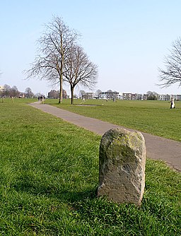
Ladies Mile. The trees along Ladies Mile are now mostly Lime trees planted after the Elms were destroyed by Dutch Elm disease.
New Seven Sisters on the Downs. The new group of fir trees planted to replace the original group of which only 3 remain (seen in the background).


