Castle Douglas to Carlingwark Loch and Threave Gardens Walk
![]()
![]() This walk takes you from Castle Douglas to Carlingwark Loch and then on to the beautiful Threave Estate and Gardens.
This walk takes you from Castle Douglas to Carlingwark Loch and then on to the beautiful Threave Estate and Gardens.
The Threave estate includes a number of waymarked walking trails taking you through the following estate sections:
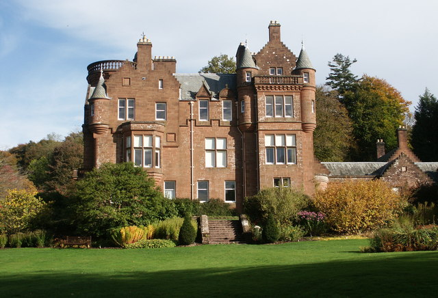
Threave House, a restored Scottish baronial-style house which has been decorated and furnished in an authentic 1930s style.
Gardens - landscaped gardens with themed 'rooms' including a Secret Garden, Patio Garden, Sculpture Garden, Rockery, Rhododendron Garden, Azalea walk, a terraced Rose Garden and heather beds.
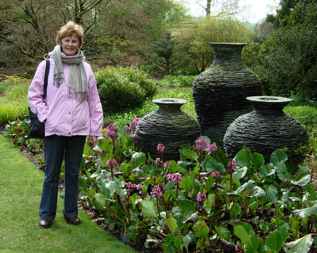
The Sculpture Garden - containing over 30 works by Scottish sculptors
Nature Reserve - with wetlands and woodlands.
Threave Gardens and Carlingwark Loch Ordnance Survey Map  - view and print off detailed OS map
Threave Gardens and Carlingwark Loch Open Street Map  - view and print off detailed map
Threave Gardens and Carlingwark Loch OS Map  - Mobile GPS OS Map with Location tracking
Threave Gardens and Carlingwark Loch Open Street Map  - Mobile GPS Map with Location tracking
Further Information and Other Local Ideas
The Rockcliffe to Kippford Walk explores a beautiful area of National Trust owned land on the Rough Firth, a few miles south east of the loch. The area includes the 6th century Mote of Mark hillfort, lovely beaches and fine views across the Solway Firth. In this area you can also enjoy a cliff top walk to the peaceful Sandyhills Bay on the Sandyhills To Kippford Coastal Walk.
To the east is the expansive Dalbeattie Forest where there's miles of walking paths and some fine mtb trails on huge granite slabs to try.
To the south west the lovely town of Kirkcudbright where there's some splendid art galleries and museums with pleasant walks along the River Dee.
Cycle Routes and Walking Routes Nearby
Photos
View across Carlingwark Loch, Castle Douglas. This delightful small loch near the centre of the town provides an excellent amenity for the people of Castle Douglas and a haven for ducks, swans, seabirds and other local wildlife. Beyond the south-western end of the loch lies the sizeable Threave estate with its famous gardens and school of horticulture. Castle Douglas is a centre for high quality food produced in the surrounding areas.
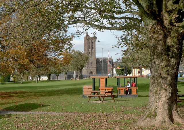
Former church north of the loch. This former church, just south of the centre of the town, is now a theatre. The park nearby extends around Carlingwark Lock and attracts many visitors and local residents who want to walk their dogs or feed the ducks. There is also a caravan site close by.
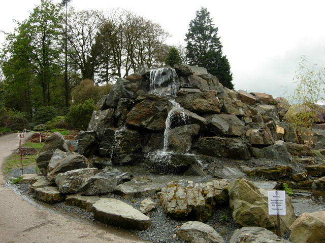
Rock Garden at Threave. This is just one of many dedicated garden areas throughout the Threave Estate which are developed and tended by the resident horticultural specialists. The gardens attract plant enthusiasts from far afield and afford very good facilities for visitors. Some enjoyable short walks can be had around and beyond the gardens including one, north westwards, to the river Dee and the ruined Threave Castle on its island.
Slate urns, Threave Gardens. These splendid slate vessels are not intended as receptacles for flowers or plants but, rather, are examples of the various sculptures and constructions placed at intervals throughout the grounds of Threave.


